The Sea Chart: An Historical Survey Based on the Collections in the National Maritime Museum [Book]
Product Specification
-
Authors: Derek Howse, Michael W. B. SandersonPages: 144Format: bookPublication Date: 1973
-
Universal Product Identifiers
ISBN: 0070306028GTIN: 09780070306028
Related Products
-
Radar 4210 Package with GMR24HD 4KW Radome & GSD22 Sounder
-
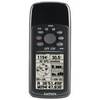
GPS 72H - Marine, hiking GPS receiver - Monochrome - 120 x 160
-
Bass Assassin Lures SSA25391 Sea Shad 10ct Chart Wooddk Soft Plastic
-
Paper Chart Kit Book REGION12 Southern & Central CA
-
Max Electronic Chart, Wide, South-West European Coasts, DVD, M-EM-M076
-
9368a Antenna F RapidFix Sat II
-
AP2401 Autopilot AP24,AC12,RC42,RF300 No Drive
-
6/3 50 Amp, 125 Volt Cable, 250' Spool, Yellow 14180
-
7ft 24AWG Cat6 500mhz Crossover Ethernet Bare Copper Network Cable - Orange
-
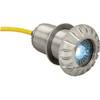
0176DP3CHR LED Thru-Hull Mount Underwater Light - Chrome Plated
-
5 Inch Power Mount Aft Lean for Universal Domes with Light Bracket Option PMA-5U-7L (PMA-57-M1 + ADA-R1) cpma5u7l
-
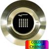
Lumishore THX72-CCP-FF Thru-Hull Flush Fit Color Change Underwater Lig