BlueChart g2 Vision - Adriatic Sea, North Coast - Maps
Model: Brand: Garmin
BlueChart g2 Vision offers the same rich detailed charting of BlueChart g2 to help you get the most out of your unit. In addition, g2 Vision features a growing database of high-resolution satellite imagery, above and below the water 3D perspective, auto guidance technology, aerial photographs for real world reference and coastal roads with points of interest. This product features detailed coverage of the Adriatic Sea from Barletta north to Monfalcone, Italy southeast to Dubrovnik, Croatia. Includes detailed coverage of Lago Maggiore, Lago d'Iseo, and Lago d'Garda in Italy. « less
Product Specification
-
General
Product Type: MapsDistribution Media: SD Memory CardFirst Seen On Google Shopping: June 2007 -
Compatibility Information
Designed For: Garmin GPSMAP 4008, 4012, 420, 4208, 420s, 4212, 430, 430s, 430sx, 430x, 440, 440s, 440sx, 440x, 450, 5008, 5012, 520, 5208, 520s, 5212, 525, 525s, 530, 530s, 535, 535s, 540, 540s, 545, 545s, 550, 550s, 555, 555s -
Universal Product Identifiers
Part Numbers: 010-C0796-00, Adriatic Sea, North CoastGTIN: 00753759069766
Related Products
-
740S/GMR24HD GPSMAP 740S Radar Pack w/GMR 24HD
-
610500 Brass Clock Chart Weight
-
PAPR03; Region 3 Paper Chart Kit
-
189 50 200t-es Ducer F EC5F EC7F ES502
-
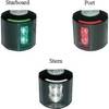
Series 43 Black LED Navigation Light Stern
-
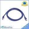
5ft 24AWG Cat5e 350MHz UTP Bare Copper Ethernet Network Cable - Purple
-
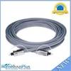
10ft Premium Optical Toslink Cable w/ Metal Fancy Connector
-
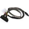
18inch SATA Data and Power Combo Cable - Dark Grey
-
Patch cable - CAT 6 - RJ-45 - M - Unshielded twisted pair (UTP) 10 ft - White
-
LTD A3030Y50 50 Amp to 30 Amp Y Adapter
-
010-11170-01 - Split Connector Collar, Threaded, RJ45
-
Inc ETS046717 Computer Hardware