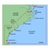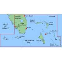
MapSource BlueChart - Southeast Florida - Maps
Model: Brand: Garmin
MapSource BlueChart is Garmin's exclusive marine cartography and was developed to provide you with mapping flexibility and options you've never had before. This line of cartography products is designed to provide interactive viewing of detailed nautical chart data, thereby providing navigators with innovative object-oriented cartography. These detailed electronic nautical charts look just like paper charts when displayed on your Garmin chartplotter. Features include shading between depth contours, spot soundings, navaids, port plans, wrecks, obstructions, inter-tidal zones, and more. BlueChart offers much larger coverage areas for half the price. MapSource BlueChart Southeast Florida covers Vero Beach south to include Lake Okeechobee, Florida Keys, Dry Tortugas, and covering the west coast of Florida north to Naples. Also covered all the Bahamas, Andros Island, Eleuthera Island, Cat Island, Great Exuma Island, Little Exuma Island, and Hog Cay. It features data from explorer charts for the Bahamas. « less
Product Specification
-
General
Product Type: MapsDistribution Media: Garmin Data CardFirst Seen On Google Shopping: January 2006 -
Compatibility Information
Designed For: Garmin GPSMap 172C, 176, 176C, 178C, 178C Sounder, 182, 182C, 188 Sounder, 188C Sounder, 196, 2006, 2006C, 2010, 2010C, 2106C, 2110C, 2206C, 2210C, 232, 238 Sounder, 276C, 292C, 296, 298C, 3006C, 3010c, 3205C, 3206C, 3210C, 376C, 392C, 396C, 492C, 498C -
Universal Product Identifiers
Part Numbers: 010-C0024-00, Southeast FloridaGTIN: 00673493492432, 00753759031718
Related Products
-
T908 Active GPS Sensor
-
NSE12 Navigation Package NSE-12, GS-15 GPS Antenna and 3G Radar
-
Package(c127 with aus, NZ, S. America, Asia Chart, 4KW 24 Inch Digital Radome & Radar Cable)
-
MapSource BlueChart - Carolinas - Maps
-
MaxSea Time Zero Explorer Marine Navigational Software with NavNet 3D Interface
-
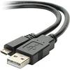
USB 2.0 A Male to Micro-B Male Cable 1.5 ft.
-
/ Quicksilver 22-33821 Connector
-
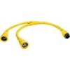
HBL64CM55 Y Adapter 2 50A 125V Cords - 50A 250V
-
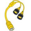
150AY Y Adapter, 2-15 20 Amp Straight Blade to 30 Amp Locking
-
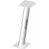
pma24u8l 24 in. Power Mount Universal Domes
-
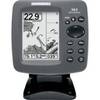
300 Series 363 Combo - Marine Chartplotter - 4" monochrome - 240 x 320
-
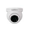
GC10 Standard Image NTSC Marine Camera