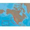
MapSource BlueChart - Carolinas - Maps
Model: Brand: Garmin
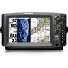
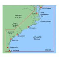
MapSource BlueChart is Garmin's exclusive marine cartography and was developed to provide you with mapping flexibility and options you've never had before. This line of cartography products is designed to provide interactive viewing of detailed nautical chart data, thereby providing navigators with innovative object-oriented cartography. These detailed electronic nautical charts look just like paper charts when displayed on your Garmin chartplotter. Features include shading between depth contours, spot soundings, navaids, port plans, wrecks, obstructions, inter-tidal zones, and more. BlueChart offers much larger coverage areas for half the price. MapSource BlueChart Carolinas covers from the Lower Chesapeake Bay at Tangier Island to St. Augustine, FL, including Norfolk, VA, Jacksonville, FL, and the entire Intracoastal Waterway between them. Also includes Albemarle Sound and the Chowan R. to Winton, NC; Pamlico Sound, Pamlico R. to Washington, NC, and Neuse R. to New Bern, NC; Savannah R. to Augusta, GA; and the St. Johns R. to Federal Pt., FL. « less
Product Specification
-
General
Product Type: MapsDistribution Media: microSD Memory CardFirst Seen On Google Shopping: January 2006 -
Compatibility Information
Designed For: Garmin eTrex Legend Cx, Vista Cx Garmin GPSMAP 60CSx, 60Cx, 76CSx, 76Cx -
Universal Product Identifiers
Part Numbers: 010-C0377-00, CarolinasGTIN: 00753759056063
Related Products
-
395 Chafe Guard Secure Removable Pr
-
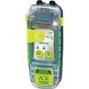
SARLink View 406 GPS PLB with Digital Display
-
CH250BB/60/240 60 kHz Black Box Searchlight Sonar System. Includes 400mm Travel Hoist and Operates at 12VDC
-
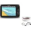
Package(c95 with USA Coastal Chart, 4KW 24 Inch Digital Radome & Radar Cable)
-
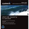
010-10800-72 Bluechart G2 Map Update
-
NaM024 CCard Format u.s.west Coast and Hawaii
-
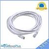
20ft 24AWG Cat6 550mhz UTP Ethernet Bare Copper Network 5015
-
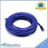
30ft 24AWG Cat6 550mhz UTP Ethernet Bare Copper Network Cable - Purple
-
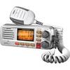
gb0533 Full-featured Fixed Mount VHF Marine Radio-white
-
200-018 - 2*180 Degree Green - LED Navigation Light
-
998c Si Combo Cho Display Only #407760-1CHO
-
Whisper Whi-500 230V, 3 KW (24Mph Wind) Wind Turbine with Controller