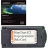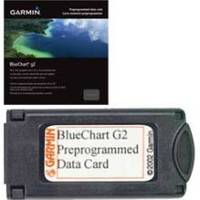
010-C0767-10 Bluechart G2 HEU009RPortugal & Northwest Spain
Model: 010-C0767-10 Brand: Garmin
See More of Your Surroundings See your surroundings more clearly with BlueChart g2 data. With BlueChart g2, you ll get detailed marine cartography that provides convenient viewing of nautical content. BlueChart g2 allows you to see your vessel s precise, on-chart position in relation to navaids, coastal features, anchorages, obstructions, waterways, restricted areas and more. You will also have access to detailed mapping capabilities that include Safety Shading , Fishing Charts , smooth data transition between zoom levels, harmonious transition across chart borders, and reduction of chart discontinuities. Realistic navigation features showing everything from shaded depth contours and coastlines to spot soundings, navaids, port plans, wrecks, obstructions, intertidal zones, restricted areas, IALA symbols and more. Smooth display presentation including seamless transitioning between zoom levels and more continuity across chart boundaries. Safety Shading allows user to enable contour shading for all depth contours shallower than user-defined safe depth. Fishing charts to help scope out bottom contours and depth soundings with less visual clutter on the display. Choice of standard 2-D direct overhead or 3-D "over the bow" map perspective to make chart reading and orientation easier. Compatible with HomePort - software that lets you use BlueChart data to conveniently plan and organize routes from your computer before your trip. « less
Product Specification
-
Universal Product Identifiers
Part Numbers: 010-C0767-10, 10804920, 35607GTIN: 00753759091576
Related Products
-
Part #407990-1 | 1198c Si Combo
-
Package(C120W, RA1048D 4KW 48 Inch HD Digital Open Array Radar & 15m Radar Cable)
-
BlueChart g2 Vision - Southwest Caribbean - Maps
-
010-C0759-10 Bluechart G2 HAW451SRed Sea Data Card
-
Waterproof Charts 15F Southwest Florida FISH/DIVE
-
Lake Champlain Fishing South - Waterproof Charts
-
Marine Naviled 360 All-Round Navigation Light
-
240-182 Digital Coaxial/Subwoofer Audio Cable 3 ft. CL2
-
#8 Red Heat Shrink Ring Connectors, 3 Per Pack
-
30 Amp to 20 Amp, 125 Volt Straight Adapter, Yellow A3020S
-
PMA6RO8L 6" Mount w/o Light Bar for Raymarine
-
120-37 Yamaha (Late model) engine I/F