Waterproof Charts 15F Southwest Florida FISH/DIVE
Model: 15F Brand:
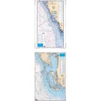
15F SOUTHWEST FLORIDA FISH/DIVEComplete offshore coverage from Tampa Bay south to 50 Miles South of Marco Island. Reverse side is coastal coverage from Englewood south to Ft. Myers Beach with complete depths for Charlotte Harbor, Pine Island Sound and Matlacha Pass. A table recompiled in FALL of 1999 contains a total of 209 Plotted and Indexed GPS/LORAN WAYPOINTS for Reefs and Wrecks, Lights and Fishing and Diving Areas. Information from 2 NOAA Charts; 11426 & 11420.25 x 38 « less
Product Specification
-
Universal Product Identifiers
Part Number: 15F
Related Products
-
E12199 SmartPilot X-30 SmartPilot Corepack
-
GPSMAP 740 GPS Chartplotter with Internal GPS Antenna 010-00835-02
-
1935 10.4 Inch Color LCD 48 NM Radar with 4KW 41 Inch Open Array
-
M504 Remote Mic Version - Black
-
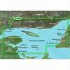
BlueChart g2 Vision - Les Mechins to St. George's Bay - Maps
-
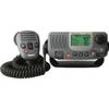
E43034 - Ray49 Class D Ultra Compact VHF
-
25ft 24AWG Cat6 550mhz UTP Ethernet Bare Copper Network Cable - Red
-
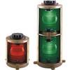
Double Lens, 360� Navigation Lights, 120V Volts, White
-
50ft 22AWG CL2 Standard HDMI to DVI Adapter Cable - Black
-
Tone Generator w/ Probe Kit 8134
-
100ft 24AWG Cat6 550mhz UTP Ethernet Bare Copper Network
-
Endura Sierra - Hiking GPS receiver - 2.7" color - 320 x 240