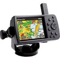
GPSMAP 376C - Marine GPS receiver - 3.8" color - 480 x 320
Model: 376C Brand: Garmin
For boaters looking for the ultimate in portability and versatility, the GPSMAP 376C has it all. This color plotter offers satellite weather capability along with both marine and land navigation modes in one space-saving package. You can even pair it with the GSD 20 remote sounder module to add sonar capability, or customize map data for your adventures on land or sea with optional MapSource cartography. « less
Product Specification
-
General
Product Type: GPS receiverRecommended Use: MarineReceiver: 12 channelCard Reader: Garmin Data CardInterface: USBCompatible Software: MapSource BlueChartSBAS: WAASDGPS: DGPS readyAntenna: DetachableAccuracy: Position - 49 ft Position - 10 ft - 16 ft ( with DGPS ) Position - 10 ft ( with WAAS )Update Rate: 1/secondFeatures: AlarmFirst Seen On Google Shopping: April 2006 -
Display
Type: TFT - colorDiagonal Size: 3.8"Resolution: 480 x 320Display Illumination: Yes -
Acquisition Times
Warm: 15 secCold: 45 sec -
Navigation
Waypoints: 3000Tracks: 15Tracklog Points: 10000Routes: 50Waypoints per route: 300 -
Connections
Interfaces: USB -
Battery
Type: Lithium ionRun Time (Up To): 15 hours -
Miscellaneous
Waterproof Standard: IPX7Included Accessories: Mounting bracket, AC power adapter, power/data cable, USB cable -
Dimensions & Weight
Width: 5.7 inDepth: 1.9 inHeight: 3.2 inWeight: 14.1 oz -
Environmental Parameters
Min Operating Temperature: 5 °FMax Operating Temperature: 140 °F -
Universal Product Identifiers
Part Numbers: 010-00438-00, 376CGTIN: 00753759049010
Related Products
-
010-11201-00 Autopilot Unbalanced Valve Kit
-
U1-200B-00A SE-200B Sonar TM 90 Degree Both Vert/Horiz w/2
-
Fishfinder 340C - Fishfinder - included transducer - dual-beam
-
Package(e125 with USA Coastal Chart, 4KW 18 Inch Digital Radome & Radar Cable)
-
PowerTower 6 Alum Open Array Sitex Simrad Garmin APT6002
-
Marine ILPB2001250 Munich LED Reading Chart Marine Light
-
E70013 C125 Multifunction Display - No Preloaded Charts
-
1032 LLB-1 Battery (1032)
-
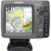
700 Series 788ci Combo CHO - Marine Chartplotter - 5" color - 640 x 640
-
Series 41 Navigation Lights White Housing, Port Side Mount
-
10ft St to SC Multimode 50/125 Duplex Fiber Optic Jumper Cable
-
Connector Kit for 3/8 Inch LED Rope Light - Imt-ilmdl-con12v-l6