010-C0747-10 Bluechart G2 HAF001REastern Africa Data Card
Model: 010-C0747-10 Brand: Garmin
General coverage of the east coast of Africa from the Gulf of Tadjoura to the Bay of Maputo, including Mogadishu, Som., Mombasa, Ken., and Dar es Salaam, Tan. Also includes general coverage of the entire coast of Madagascar. Includes detailed coverage of Djibouti, Dji., Maputo, Moz., Mauritius, Reunion, and the Seychelles. See your surroundings more clearly with BlueChart g2 data. With BlueChart g2, you'll get detailed marine cartography that provides convenient viewing of nautical content. BlueChart g2 allows you to see your vessel's precise, on-chart position in relation to naviads, coastal features, anchorages, obstructions, waterways, restricted areas and more. You will also have access to detailed mapping capabilities that include Safety Shading , Fishing Charts , smooth data transition between zoom levels, harmonious transition across chart borders, and reduction of chart discontinuities. « less
Product Specification
-
Universal Product Identifiers
Part Numbers: 010-C0747-10, 10804532, 35575GTIN: 00753759089634
Related Products
-
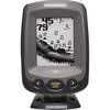
PiranhaMAX 180 - Fishfinder - included transducer : XNT-9-QB-90-T - triple-beam
-
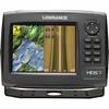
HDS-7 Gen2 Fishfinder GPS Chartplotter 53518700
-
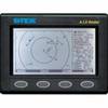
AIS Radar with 5 in Display Requires VHF Ant
-
MDS-10-4 Radar Sensor 4KW 4 Array 1/8-48 NM
-
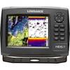
53518900 HDS-7 Gen2 Insight USA 50/200kHz
-
BlueChart g2 Vision - Hawaiian Is. - Mariana Is. - Maps
-
Paper Chart Kit Book REGION12 Southern & Central CA
-
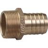
3" Pipe to Hose Adapter
-
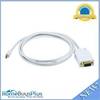
6ft 32AWG Mini DisplayPort | Thunderbolt to VGA Cable - White
-
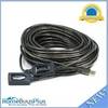
65ft 20m USB 2.0 A Male to A Female Active Extension / Repeater Cable (Kinect & PS3 Move Compatible Extension)
-
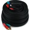
50ft 22AWG 5-rca Component Video/audio Coaxial Cable (RG-59/U) - Black
-
409050-1 386ci Di Combo