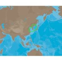
AN-M203 C-Card Format Yellow Sea & Malaya
Model: AN-M203 Brand: C-Map
Coverage of Yellow Sea to Malaya cover's Jiatiao Port - Xiangshan Harbour - Zhoushan City - Qantangjiang River Mouth - Zhoushan Archipelago - Yangtze River - Doulong Harbour Entrance - She-Yang River Mouth - Guan River Mouth - Lianyungang Port - Lanshan Harbour - Rizao Harbour - Quingao Port - Aoshan Port - Nudao Port - Entrance to Dingzi River - Jinghai Bay - Shidao Bay - Rongcheng Bay - Weihat Bay - Yantai Port - Penglari Port - Sanshan Head - Xiaoqinghe Mouth - Dongying Port - Tao Er River Entrance - Tianjing Port - Quinhuangdao Port - Pulanddian Bay - Dalian Bay - Changshan Archipelago - Shicheng Island - Dadong Port - Nampo Hang - Daesan Hang - Gyema Hang - Sinyang Port - T Aepaek - Zaliv Pos Yeta - Zaliv Nakhodka - Wakamatsu Island - Omura Wan - Matsuura Ko - Iki Island - Kita-kyushi - Seto Naikai - Komatsu and Toyama. « less
Product Specification
-
Universal Product Identifiers
Part Number: AN-M203C-CARDGTIN: 00686074013223
Related Products
-
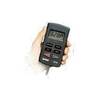
SP-70MT Autopilot for Cable Steer Tilt Type Helms st70mt
-
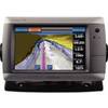
GPSMAP 720 GPS Chartplotter with Internal GPS Antenna 010-00835-00
-
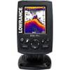
Elite-4x Sonar with 83/200kHz Transom Mount Transducer 000-10484-001
-
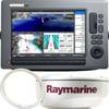
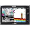
T62291 C Series Widescreen System Packs
-
Max Lakes West NA-M020 c30551
-
BlueChart g2 Vision - St. Lawrence Seaway - Maps
-
e165 15.4 Display Multifunction Coastal Chart #E70025-US
-
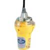
Smartfind Plus G5 GPS EPIRB Automatic Cat I
-
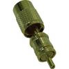
F-Type-Cp/Gh-01 Connector for RG-6U Cable
-
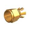
DA645G Mini-UHF Adapter
-
Corp mdl T Connector ILMDL-T
-
Pro Series HD Thru-Hull Underwater Light, 3010TH-HD