010-C0774-10 Bluechart G2 HEU016RMediterranean Southeast Data
Model: 010-C0774-10 Brand: Garmin
See your surroundings more clearly with BlueChart g2 data. With BlueChart g2, you'll get detailed marine cartography that provides convenient viewing of nautical content. BlueChart g2 allows you to see your vessel's precise, on-chart position in relation to naviads, coastal features, anchorages, obstructions, waterways, restricted areas and more. You will also have access to detailed mapping capabilities that include Safety Shading, Fishing Charts, smooth data transition between zoom levels, harmonious transition across chart borders, and reduction of chart discontinuities. Covers: From Gulluk, Turkey east to include Cyprus, Syria, Lebanon and Israel, then west to Misratah, Libya. « less
Product Specification
-
Universal Product Identifiers
Part Numbers: 010-C0774-10, 10805075, 35621GTIN: 00753759091712
Related Products
-
GHP 20 Corepack for Viking Steering Systems
-
Marine Pollution Including Ocean Acidification, Eutrophication, Marine Debris, Mercury in Fish, and Active Sonar [Book]
-
GMR 24 4KW Digital Radar Scanner
-
Max IN-M203 W68 Gulf of Martaban to Jakarta-MAX
-
2" 2-3/8" 3-5/8" Perko Thru Hull Connection for Pipe
-
M72-11 Hand Held VHF w/Built in Scrambler
-
Marinenav Leviathan Marine Navigation PC Computer LEV-017R-AMD
-
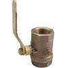
0825004PLB Seacock Body 1/2in Bronze
-
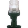
All-Round Light, Fixed Mount
-
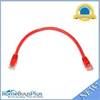
1ft 24AWG Cat6 550mhz UTP Ethernet Bare Copper Network Cable - Red
-
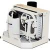
FCF-16000 Feel Cool Fast Marine Air Conditioner by Webasto
-
408950-1 Fishfinder 598ci HD Si Combo