Western U.S. Fishing Maps Sea of Cortez North Chart
Model: Brand: Fish-n-Map
FISH-N-MAP UNDERWATER TOPOGRAPHY MAPSMade of waterproof, tear resistant plastic. Features include: underwater depth contours, fish locations, latitude and longitude for GPS, multiple freshwater lakes on one map, boat ramps, recreational facilities and much more.
Product Specification
-
Universal Product Identifiers
Part Numbers: 317166, 7123GTIN: 00761428071231
Related Products
-
000-10612-001 Triton Pilot Computer - Low Current
-
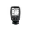
Fishfinder echo 100 - Fishfinder - included transducer
-
BlueChart g2 Vision - Mobile to Lake Charles - Maps
-
Marine World Chart of Nicolo de Canerio Januensis, Circa 1502: A Critical Study (1908) [Book]
-
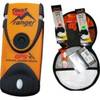
Fast Find Ranger PLB Promo WFast Find Safety Kit
-
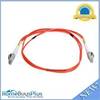
Fiber Optic Cable, LC/LC, Multi Mode, Duplex - 1 Meter 6202
-
Filters 85-1350 Vent Kit Marine, 1/2 Flange
-
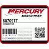
/ Quicksilver 807097T Connector
-
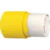
HBL328DCC 30amp 28V DC Yellow Locking Connector Body - Female
-
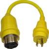
30 Amp to 20 Amp, 125 Volt Straight Adapter, Yellow A3020S
-
Cat6a Ethernet Cable | 10ft | Black | Network | 10 Gigabit
-
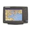
GlobalMap 8200C - Marine GPS receiver - 8.4" color - 600 x 800