010-C0749-10 Bluechart G2 HAF003RWestern Africa Data Card
Model: 010-C0749-10 Brand: Garmin
General coverage of the west coast of Africa from El Aaraich, Mor. to Cape Cross, Nam., including Abidjan, C.I., Douala, Cam. and Luanda, Ang. Included in this overall general coverage are a number of detailed charts covering areas such as Casablanca, Mor., Dakar, Sen., and Lagos, Nig. Also includes general coverage of St. Helena Is., Ascension Is., and the Azores. Also includes detailed coverage of the Madeira Islands, Canary Islands, and Cape Verde Islands. See your surroundings more clearly with BlueChart g2 data. With BlueChart g2, you'll get detailed marine cartography that provides convenient viewing of nautical content. BlueChart g2 allows you to see your vessel's precise, on-chart position in relation to naviads, coastal features, anchorages, obstructions, waterways, restricted areas and more. You will also have access to detailed mapping capabilities that include Safety Shading , Fishing Charts , smooth data transition between zoom levels, harmonious transition across chart borders, and reduction of chart discontinuities. « less
Product Specification
-
Universal Product Identifiers
Part Numbers: 010-C0749-10, 10804573, 35579GTIN: 00753759089672
Related Products
-
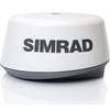
BR24 Broadband Radar for NSE-Series 20m Cable #AA010221
-
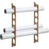
Ultra Marine Chart Caddy, Teak
-
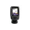
Fishfinder echo 300c - Fishfinder - included transducer - dual-beam
-
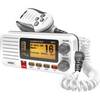
UM415 Oceanus D Marine Radio (White)
-
E12203 SmartPilot X-5 Tiller Autopilot
-
5in Plain Bronze Door Hook
-
Cabin Door Hook, Bronze, 3-1/2"
-
4KW 24in Radome No Cable E52080
-
1ft 14AWG Power Cord Cable w/ 3 Conductor PC Power Connector Socket (C13/5-15P) - Black
-
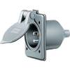
Wiring Device-Kellems HBL61CM64 Inlet,marine,15 A 3d235
-
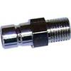
80400 Honda Fuel Connector
-
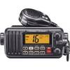
M412 12 Fixed-Mount 25W VHF Marine Radio with Class D DSC (W