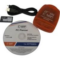
PCPLANNER2 PC Planner - NT+/MAX 2MB
Model: PCPLANNER2 Brand: C-Map
PC-Planner Turn your PC into a virtual chart plotter, while using your actual C-Map electronic chart in the process. Now use PC-Planner to access all of the functions normally found in your chart plotter. With PC-Planner you can view actual chart data, create and change routes, accurately measure distances, and add and edit waypoints and marks. Easily transfer your trip plans to a C-Map Memory Card, plug it into your chart plotter, and load your routes on the spot. This means can get on your boat; turn on your chart plotter; load your trip data; turn on your engine and you're off. Use the same C-Map chart you use in your chart plotter and your PC will mirror the detail you see onboard your boat. Access all of the planning data that C-Map charts offer, including: [+] Coastal Navigation Data [+] Depth Contour Data [+] Spot Soundings [+] Port Information [+] Marina Information [+] Tide Data> « less
Product Specification
-
Universal Product Identifiers
Part Numbers: 15847, PCPLANNER2GTIN: 000000158473, 158473
Related Products
-
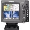
700 Series 798c SI Combo NVB - Fishfinder - included transducer : XNT-9-SI-180-T - dual-beam
-
ST1000 Plus Tiller Autopilot Tiller Autopilot St2000+ A1200
-
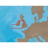
EW-C207 Furuno FP Format - Bristol Channel & Irish Sea
-
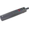
Mr F75-D Marine Class-D Digital Selective Calling Technolog
-
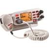
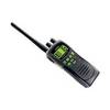
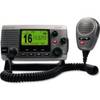
ATLANTIS 250 VHF Two-way radio
-
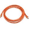
14ft 24AWG Cat6 500mhz Crossover Ethernet Bare Copper Network Cable - Orange
-
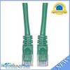
Cat6a Ethernet Cable | 10ft | Green | Network | 10 Gigabit
-
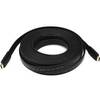
4163 30ft 24AWG CL2 Flat Standard HDMI Cable - Black
-
5ft 24AWG CL2 High Speed HDMI Cable w/ Net Jacket - Black
-
1ft 16AWG Power Cord Cable w/ 3 Conductor PC Power Connector Socket (C13/5-15P) - Black
-
Marine Products Plug Wire Set 9-28033
-
34170 Vhf-200 VHF Radio W/class-d DSC