Olympic Coast National Marine Sanctuary Habitat Mapping: Survey Report and Classification of Side Scan Sonar Data from Surveys Hmpr-114-2004-02 and Hmpr-116-2005-01 [Book]
Model: Hmpr-114-2004-02 Brand:
OCLC Number: (OCoLC)72698519 Subject: Habitat surveys -- Washington (State) -- Olympic Coast National Marine Sanctuary. Excerpt: ... In general, soft substrates occur in the southern portion of the survey block, and continue to the west throughout the majority of block 116_0501n ( Figure 8 ). We easily delineated several areas of sediment waves, indicating active sediment movement occurring in specific areas. Figure 6. Example of hard, complex rocky bottom, providing a habitat for basket star, white-plumed anemone and rockfish. Table 2. Distribution of bottom hardness for each sonar mosaic classified from survey HMPR-114-2004-02 and HMPR-116-2005-01. See Figure 1 for area locations. Bottom hardness codes are hard ( h ), mixed ( m ) and soft ( s ) - see previous section for description of classes. Area is presented in square meters ( top value ) and area as percentage of each individual mapped area ( bottom bold value in the matrix ). Year Survey Block h m s 2004 114_0402b 3,553,093.3 7,371,749.0 8,817,661.4 18.0 37.3 44.7 114_0402c 266,065.6 1,001,958.9 0.0 21.0 79.0 0.0 2005 116_0501c 738,181.5 2,503,968.7 0.0 22.8 77.2 0.0 116_0501d 280,836.0 2,420,793.9 0.0 10.4 89.6 0.0 116_0501n 10,240.0 341,667.0 19,842,000.0 0.0 1.7 98.3 116_0501s 0.0 0.0 7,585,526.0 0.0 0.0 100.0 7 « less
Product Specification
-
Authors: U.S. GovernmentPages: 44Format: paperbackPublication Date: 2012.06
-
Universal Product Identifiers
ISBN: 1234472023GTIN: 09781234472023
Related Products
-
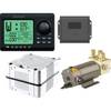
AP2803VRF Autopilot AP28, AC12 Computer, RC42 Rate Compass, RPU80 Pumpset
-
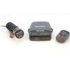
S1000 Autopilot Wireless E12169 C16576
-
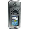
GPSMAP 76Cx - Marine, hiking GPS receiver - 2.6" color - 160 x 240
-
IR2 4.4 4KW 4.5 Foot Open Array Radar R-0006
-
Package(C90W, DSM300G Sounder, 4KW 18 Inch Digital Radome & Radar Cable)
-
NA-C401 Furuno FP Format - St. Lucie Inlet - LK Pontchart
-
NaC313 CCard Format Muscongus Bay Cape May Bathy
-
0805005PLB 3/4" Seacock Ball Valve Bronze
-
000-10530-001 HDS-7 Gen2 Insight USA 83/200kHz
-
25ft 24AWG Cat5e 350MHz UTP Bare Copper Ethernet Network Cable - Pink
-
75ft Premium Optical Toslink Cable w/ Metal Fancy Connector
-
RINO 110 - Hiking GPS receiver / two-way radio - Monochrome - 160 x 160