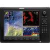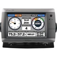
GPSMAP 720s - Marine Chartplotter - 7" color - 800 x 480 - widescreen
Model: 720s Brand: Garmin
GPSMAP 720s is a stand-alone touchscreen chartplotter that brings a high level of functionality to your vessel. Featuring a brilliant 7-inch display, GPSMAP 720s puts all the information you need right at your fingertips. In addition, GPSMAP 720s accepts radar input and offers full NMEA 2000 connectivity for greater convenience when adding extra sensors. « less
Product Specification
-
General
Product Type: ChartplotterRecommended Use: MarineCard Reader: SD Memory CardInterface: NMEA 0183, NMEA 2000Functions & Services: Tide TabCompatible Software: BlueChart g2 VisionAntenna: Built-inFeatures: Alarm, XM Satellite Radio support, XM weather supportFirst Seen On Google Shopping: March 2010 -
Display
Type: LCD - color - touch screenDiagonal Size: 7" - widescreenResolution: 800 x 480 -
Navigation
Waypoints: 3000Tracks: 50Tracklog Points: 20000Routes: 100Trip Computer: Sun/moon positions -
Connections
Interfaces: Garmin Marine Network -
Miscellaneous
Waterproof Standard: IPX7 -
Dimensions & Weight
Width: 8.8 inDepth: 3.1 inHeight: 5.6 inWeight: 2.4 lbs -
Universal Product Identifiers
Part Numbers: 010-00835-01, 720sGTIN: 00753759099893
Related Products
-
Dd15 Mechanical Pump Drive 21119896
-
NA-C502 Furuno FP Format Western Caribbean S
-
MSD/647P+ Platinum Plus Lake Superior on SD/MicroSD
-
Cat6a Ethernet Cable | 25ft | Green | Network | 10 Gigabit
-
000-10345-001 - NSE12 Navigation Pack
-
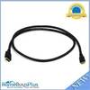
6ft 30AWG High Speed HDMI Cable - HDMI Connector to HDMI Mini Connector - Black
-
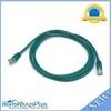
5ft 24AWG Cat5e 350MHz UTP Bare Copper Ethernet Network Cable - Green
-
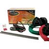
NMEA1 Trim Tab Indicator Kit, NMEA
-
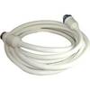
30 Amp 25' Cord Set - White - 125V
-
Split Connector 6ft Right Angle RJ45 Plug
-
164AY Y Adapter 2-50 Amp Locking to 50 Amp Straight
-
RoadMate RV 9145-LM - Automotive GPS receiver - 7" color - 800 x 480 - widescreen