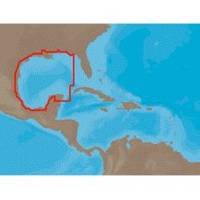
NA-C402 Pensacola Bay to Honduras
Model: NA-C402 Brand: C-Map
C-Map NT+ Cartography is the "next generation" of C-MAP electronic charts, featuring much wider coverage areas at substantially lower prices. NT+ electronic charts are derived from official paper charts. Vastly Expanded Coverage:Important advances in techn
Product Specification
-
Universal Product Identifiers
Part Numbers: 19563, CMANAC402CCARD, CMANAC402FP, C-MAP NA-C402, CW-19563, NA-C402, NA-C402C-CARDGTIN: 000000099677
Related Products
-
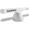
Pedestal for Gmr404 & 406 Arrays Arrays, 20 1/2"W x 12 3/4"H
-
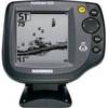
500 Series 525 - Fishfinder - included transducer : XNT-9-20-T - single-beam
-
Quatsino Sound Chart
-
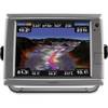
010-00749-01 - GPSMAP 7212, 12 Tchscrn MFD, Coast Map
-
E42001 RAY240 VHF
-
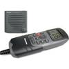
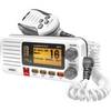
UM415 Oceanus D Marine Radio (White)
-
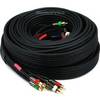
35ft 18AWG CL2 Premium 5-rca Component Video/audio Coaxial Cable (RG-6/U) - Black
-
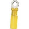
#8 Red Heat Shrink Ring Connectors, 3 Per Pack
-
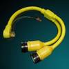
164AY Y Adapter 2-50 Amp Locking to 50 Amp Straight
-
5 Inch Power Mount Aft Lean for Universal Domes with Light Bracket Option PMA-5U-7L (PMA-57-M1 + ADA-R1) cpma5u7l
-
Cat6a Ethernet Cable | 7ft | Green | Network | 10 Gigabit
-
Cat6a Ethernet Cable | 50ft | Blue | Network | 10 Gigabit