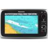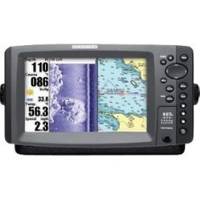
900 Series 997c SI Combo CHO - Marine Chartplotter - 8" color - 800 x 480 - widescreen
Model: 997c Brand: Humminbird
The 997c SI Combo CHO features a brilliant color, wide-screen 8" display, side imaging and DualBeam PLUS sonar with up to 8000 Watts PTP power output, GPS Chartplotting with built-in UniMap, and advanced fishing system capabilities.
Product Specification
-
General
Product Type: ChartplotterRecommended Use: MarineFunctions & Services: SpeedCompatible Software: Navionics Gold, Navionics HotMaps PremiumFirst Seen On Google Shopping: March 2008 -
Display
Type: TFT - colorDiagonal Size: 8" - widescreenResolution: 800 x 480Display Illumination: YesFeatures: Split screen zoom, Real Time Sonar (RTS) window, TrueArch, sonar echo enhancement, Selective Fish ID+, sonar recording -
Transducer
Transducer Presence: Optional transducerTransducer Type: Dual-beamTransducer Mount: TransomMaximum Depth: 1500 ftTarget Separation: 2.5 inBeamwidth: 20/60/(2)55/(2)86 degreesOperating Frequency: 83/200/455/800 kHzPower Output (Peak to Peak): 8000 WPower Output (RMS): 1000 WTransducer Features: Built-in temperature sensor, side imaging -
Navigation
Waypoints: 3000Tracks: 50Tracklog Points: 20000Routes: 50 -
Power
Low Voltage Power: DC 10 - 20 V -
Miscellaneous
Protection: Waterproof -
Dimensions & Weight
Width: 11 inDepth: 4 inHeight: 6 in -
Universal Product Identifiers
Part Numbers: 406970-1CHO, 997c SI Combo CHOGTIN: 00082324031861
Related Products
-
RoadMate 2036 - Automotive GPS receiver - 4.3" color - 480 x 272
-
41759 Broadband 3G Radar
-
Rockport to Bangor, Maine Nautical Marine Charts - Waterproof Charts
-
T70026 C95 Multifunction Display w/US Inland Charts
-
Max EN-M019 MW4 North and Baltic Seas-MAX
-
The Nautical Chart [Book]
-
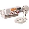
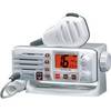
RADIO-FIX VHF Class-D DSC Wht
-
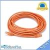
25ft 24AWG Cat5e 350MHz UTP Bare Copper Ethernet Network Cable - Orange
-
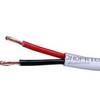
50ft 12AWG CL2 Rated 2-Conductor Loud Speaker Cable (for In-Wall Installation)
-
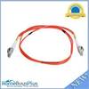
Fiber Optic Cable, LC/LC, Multi Mode, Duplex - 1 Meter 6202
-
Eclipse DSC GX1000 - VHF Marine Radio
-
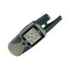
RINO 120 - Hiking GPS receiver / two-way radio - Monochrome