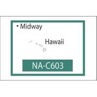
NT+ NA-C603F The Hawaiian Islands
Model: NA-C603F Brand: C-Map
C-MAP has set the standard for electronic charts with five consecutive NMEA awards for Best Electronic Cartography. The spring 2004 C-MAP NT+ release will include marina detail for over 1,000 US marinas in C-MAPs private collection. Now you will be able to see slip detail as well as the locations for onshore facilities. Finding the right chart plotter for you is easy with 17 manufacturers powered by C-MAP. Just look for the NT+ logo. « less
Product Specification
-
Universal Product Identifiers
Part Number: NA-C603.FGTIN: 00686074002272
Related Products
-
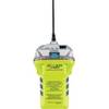
2848.0 Globalfix iPro 406 MHz GPS EPIRB - Category 2
-
29035 GMR 18 / 4 KW Digital Marine Radar Scanner
-
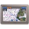
GPSMAP 640 - Marine, automotive Chartplotter - 5.2" color - 800 x 480
-
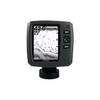
Fishfinder echo 200 - Fishfinder - included transducer - dual-beam
-
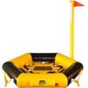
Throw Water Activated Rescue Platform
-
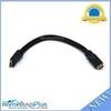
1ft 24AWG CL2 High Speed HDMI Cable w/ Net Jacket - Black
-
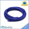
25ft 24AWG Cat6 550mhz UTP Ethernet Bare Copper Network Cable - Purple
-
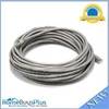
30ft 24AWG Cat6 550mhz UTP Ethernet Bare Copper Network Cable - Gray
-
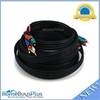
25ft 22AWG 5-rca Component Video/audio Coaxial Cable (RG-59/U) - Black
-
595 50ft S-Video Svideo M/F Extension Cable
-
IEEE 1394 cable - 9 pin FireWire 800 - M - 15 ft - PC
-
Lumishore Thru-Hull Underwater Light - Blue - 120W