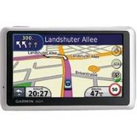
n�vi 1350T - Hiking, automotive GPS receiver - 4.3" color - 480 x 272 - widescreen
Model: 1350T Brand: Garmin
The widescreen nuvi 1350T adds free traffic alerts to the nuvi 1350. In addition, this ultra-thin GPS announces streets by name, guides you to the proper lane for navigation and calculates a more fuel-efficient route with ecoRoute.
Product Specification
-
General
Product Type: GPS receiverRecommended Use: Hiking, automotivePreloaded Maps: Canada, USACard Reader: microSDInterface: USBFunctions & Services: Distance, elevation, time/date, Lane AssistantTraffic: TMC (Traffic Message Channel), MSN DirectVoice: Navigation instructions, street name announcementIncluded Software: MapSource City Navigator North America NT, NAVTEQCompatible Software: Garmin CityXplorer, Garmin Travel GuideAntenna: Built-inFirst Seen On Google Shopping: April 2009Features: ecoRoute, built-in speaker, calculator, clock, speed limit warning, 2D / 3D map perspective, Garmin Lock, photo viewer, custom POIs, downloadable POIs, preinstalled POIs, automatic routing, measurement converter, currency converter, Garmin Garage, Garmin HotFix, Emergency Help -
Display
Type: TFT - color - touch screenDiagonal Size: 4.3" - widescreenWidth: 3.8 inHeight: 2.2 inResolution: 480 x 272Display Illumination: YesFeatures: Anti-glare -
Navigation
Waypoints: 1000Routes: 0Trip Computer: Avoid highways, trip timer, trip distance, quickest route, avoid toll roads, fast/short route, street address search -
Media Player
Supported Image Formats: JPG -
Connections
Interfaces: USB -
Battery
Type: Lithium ionRun Time (Up To): 4 hours -
Miscellaneous
Included Accessories: Dashboard disc, car power adapter with TMC antenna, suction cup mountLocalization: North America -
Dimensions & Weight
Width: 4.8 inDepth: 0.6 inHeight: 3 inWeight: 5.7 oz -
Universal Product Identifiers
Part Numbers: 010-00782-26, 1350TGTIN: 00041594071007, 00053759090914, 00689466093896, 00689466093902, 00753759090913, 00753759095352, 00753759096335
Related Products
-
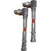
010-11204-00 Autopilot Isolation Hose Kit
-
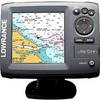
Elite 5M Base US Chartplotter 145-001
-
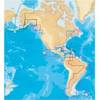
37673 Platinum Plus South Alaska on SD Micro SD
-
010-C0759-20 Bluechart G2 HXAW451SRed Sea Microsd/sd Adaptor
-
The Sea Chart: An Historical Survey Based on the Collections in the National Maritime Museum [Book]
-
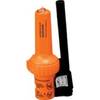
86-300-001A S-4 Sart
-
2" IPS Intake Strainer Bronze Made in The USA
-
0493DP999N Cork Gasket
-
1530PCM35L 125VAC - 15 Amp -to- 125VAC - 30 Amp 35 Foot
-
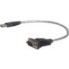
1ft USB to Serial Cable
-
Digital Mini-UHF Crimp Connector D A8117
-
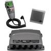
0100075700 VHF 300 AIS