Marine Navigation Workbook: Piloting and Celestial and Electronic Navigation [Book]
Product Specification
-
Authors: Richard R. HobbsPages: 393Format: hardbackPublication Date: June 1, 1990Key Terms: Loran-C, Nautical Almanac, set and drift, sextant, Polaris, gyrocompass, FOMALHAUT, nautical chart, celestial navigation, Mercator chart, ARCTURUS, azimuth, Achernar, U.S. Navy, Acrux, LEARNING OBJECTIVES, weather fronts, Tide Tables, Notice to Mariners, Kochab
-
Universal Product Identifiers
ISBN: 1557505519GTIN: 09781557505514
Related Products
-
44484 Structure Scan HD w/ Xdsr LSS-2
-
MapSource BlueChart - Yellow Sea - Maps
-
MapSource BlueChart - Southeast Caribbean - Maps
-
Max EW-M019 L75 English Channel Western-MAX
-
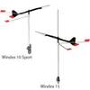
3120 Windex 10 Sport Wind Indicator
-
40 Stern Yellow Nav Light 12v/10w
-
Cable Ci 14-2 W PB500 Contractor 14-Gauge Speaker
-
VGA Male to Male Cable 15 ft. CL2
-
G120 12" Inverted Marine Display 38327
-
Flush Mount Scupper Adapters, Flush Mount Scupper Adapter Black th
-
B75-20-L Broadband Chirp 20 Degree Tilt, No CONNECTOR, Depth & Temperature Thru-Hull Tilted
-
34210 A50D 5" Combo w/ Coastal Maps, Int GPS