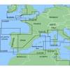
MapSource BlueChart - Yellow Sea - Maps
Model: Brand: Garmin
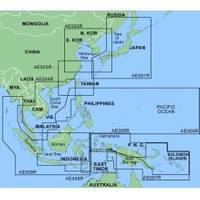
MapSource BlueChart is Garmin's exclusive marine cartography and was developed to provide you with mapping flexibility and options you've never had before. This line of cartography products is designed to provide interactive viewing of detailed nautical chart data, thereby providing navigators with innovative object-oriented cartography. These detailed electronic nautical charts look just like paper charts when displayed on your Garmin chartplotter. Features include shading between depth contours, spot soundings, navaids, port plans, wrecks, obstructions, inter-tidal zones, and more. BlueChart offers much larger coverage areas for half the price. MapSource BlueChart Yellow Sea offers general coverage of the Chinese coast from Wenzhou to Dandong, the North and South Korean coasts in their entirety, and the Russian coast east to Nakhodka. Also includes general coverage of the southern tip of Japan from Yonago around to Kochi. Included in this overall general coverage are numerous detailed charts covering areas in China such as Shanghai, Qingdao, and Dalian, and also Nampo, N.Kor., Pusan, S. Kor., Chongjin, N. Kor., and Nagasaki and Fukuoka in Japan. « less
Product Specification
-
General
Product Type: MapsDistribution Media: microSD Memory CardFirst Seen On Google Shopping: January 2006 -
Compatibility Information
Designed For: Garmin eTrex Legend Cx, Vista Cx Garmin GPSMAP 60CSx, 60Cx, 76CSx, 76Cx -
Universal Product Identifiers
Part Numbers: 010-C0289-00, Yellow Sea
Related Products
-
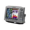
HDS-7 - Marine Chartplotter - 6.4" color - 640 x 480
-
15m Marine Radar Power Cable Only 320-00246-00
-
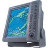
RDP150 12.1 Color LCD Radar Display
-
FR8062 12.1 Inch 6KW, 72 nm, 12.1 Color Display Radar without Antenna
-
MapSource BlueChart - Irish Sea - Maps
-
000-10787-001 RS12 DSC VHF Radio
-
XGPS150 - Marine, hiking, automotive, cycle, golf, running GPS receiver
-
JQE-103 EPIRB System
-
Methods and Algorithms in Navigation: Marine Navigation and Safety of Sea Transportation [Book]
-
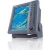
NavNet 3D Color 12.1" LCD Multifunction Display
-
100ft 24AWG Cat6 550mhz UTP Ethernet Bare Copper Network
-
407150-1M 1157CX 10.4" GPS Chartplotter Combo Internat