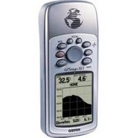
GPSMAP 76S - Marine, hiking GPS receiver - Monochrome - 240 x 180
Model: 76S Brand: Garmin
If you're a devoted mariner or serious outdoor enthusiast, Garmin GPSMAP 76S is the GPS/mapping unit for you. The "S" in the product name stands for "sensors", because the GPSMAP 76S incorporates a GPS receiver, barometric altimeter, and an electronic compass that deliver precise location, elevation, and bearing information to take adventurers as high or as far as they want to go. The unit also contains a basemap of North and South America, including major highways, thoroughfares, rivers, lakes, and borders, with plenty of memory (24 MB) for downloading MapSource data. It's also waterproof and floats in water - and its larger screen, increased readability, bigger buttons, and rugged design make this unit at home in even the harshest conditions. « less
Product Specification
-
General
Product Type: GPS receiverRecommended Use: Marine, hikingPreloaded Maps: South America, Canada, USA, Alaska, Central America, MexicoReceiver: 12 channelInterface: Serial, NMEA 0183, RTCM SC-104 DGPSFunctions & Services: Electronic compass, speedIncluded Software: Garmin Americas Highway BasemapGrids: UTM, MGRS, Lat/Lon, UPS, Loran TDs, MaidenheadSBAS: WAASDGPS: DGPS readyAntenna: Built-inAccuracy: Position - 49 ft Position - 10 ft - 16 ft ( with DGPS ) Position - 10 ft ( with WAAS ) Velocity - 0.16 ft/secUpdate Rate: 1/secondInternal Memory: 24 MB flashFeatures: Barometer, barometric altimeterFirst Seen On Google Shopping: May 2003 -
Display
Type: LCD - monochromeResolution: 240 x 180Display Illumination: Yes -
Acquisition Times
Warm: 15 secCold: 45 sec -
Navigation
Waypoints: 500Tracklog Points: 5000Routes: 50Waypoints per route: 50Trip Computer: TracBack -
Battery
Type: AA typeRequired Qty: 2Run Time (Up To): 10 hours -
Miscellaneous
Protection: WaterproofWaterproof Standard: IPX7Localization: English -
Dimensions & Weight
Width: 2.7 inDepth: 1.2 inHeight: 6.2 inWeight: 16 oz -
Manufacturer Warranty
Service & Support: 1 year warranty -
Environmental Parameters
Min Operating Temperature: 5 °FMax Operating Temperature: 158 °F -
Universal Product Identifiers
Part Numbers: 010-00271-00, 76SGTIN: 00689076566957, 00753759032029
Related Products
-
Video Sboatsmdvd DVD Boaters Guide to Twin
-
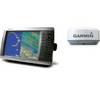
Radar 4210 Package with GMR18 4KW Radome
-
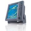
FR8062 12.1 Inch 6KW, 72 nm, 12.1 Color Display Radar 6' Open Array Antenna fr80626
-
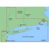
MapSource BlueChart - New York - Maps
-
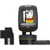
Fishin' Buddy 140c - Fishfinder - portable - included transducer - single-beam
-
Max Mega Wide International cmegai
-
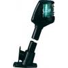
Powerboat Navigation Light, All Round Plug In, 48"
-
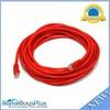
20ft 24AWG Cat6 550mhz UTP Ethernet Bare Copper Network Cable - Red
-
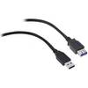
USB 3.0 | Extension Cable | 15ft | Type A | Male/Female | Black
-
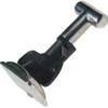
TM00700 Connector Stainless
-
Rareelectrical B0055eabf0 New Coleman PowerMate Marine Generator
-
Air Conditioner 115V Fcf5000 (836-FCF0005000GS)