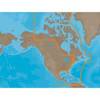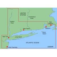
MapSource BlueChart - New York - Maps
Model: Brand: Garmin
MapSource BlueChart is Garmin's exclusive marine cartography and was developed to provide you with mapping flexibility and options you've never had before. This line of cartography products is designed to provide interactive viewing of detailed nautical chart data, thereby providing navigators with innovative object-oriented cartography. These detailed electronic nautical charts look just like paper charts when displayed on your Garmin chartplotter. Features include shading between depth contours, spot soundings, navaids, port plans, wrecks, obstructions, inter-tidal zones, and more. BlueChart offers much larger coverage areas for half the price. MapSource BlueChart New York provides detailed coverage of Providence to New York, includes Narragansett Bay, all of Long Island, the entire Hudson River, New York Harbor through Perth Amboy and Brick Township. « less
Product Specification
-
General
Product Type: MapsDistribution Media: Garmin Data CardFirst Seen On Google Shopping: January 2006 -
Compatibility Information
Designed For: Garmin GPSMap 172C, 176, 176C, 178C, 178C Sounder, 182, 182C, 188 Sounder, 188C Sounder, 196, 2006, 2006C, 2010, 2010C, 2106C, 2110C, 2206C, 2210C, 232, 238 Sounder, 276C, 292C, 296, 298C, 3006C, 3010c, 3205C, 3206C, 3210C, 376C, 392C, 396C, 492C, 498C -
Universal Product Identifiers
Part Numbers: 010-C0018-00, New YorkGTIN: 00753759031657
Related Products
-
CP450C ClearPulse Chirp Sonar Sounder Module
-
Memory Map MAR-UKI-11 Memory-Map Marine Chart - UK & Ireland 2011 Edition
-
NA-C702 Furuno FP Format Nanoose - Victoria
-
NA-C304 Furuno FP Format Norfolk Bermuda Jac
-
NAM033SD Mega Wide Atlantic CST & Carib
-
Base Mount White Masthead Navigation Lights Light, 225
-
0834005PLB 3/4 Seacock w/Curved Tail PC
-
176 Marine Navigation Ultralight Divider
-
E12205 X-Sol Corepack Use with Solenoid Drive Systems
-
30 Amp 75' Cord Set - Yellow - 125V
-
3ft Premium Optical Toslink Cable w/ Metal Fancy Connector
-
HST-DFSBL Transom Mount Transducer 50/200kHz Depth and Temp Blue Connector wdfsbl