Max Mega Wide International cmegai
Model: Brand: C-Map
Dynamic tides and currents predict the time, level, direction and strength of currents and tides. Guardian Alarm performs an automatic forward-scanning check for obstacles. Use this feature as an added backup to alert you if you head toward a potentially harmful object. Photos and diagrams in high-definition of ports, marinas and significant navigational marks will help you to familiarize yourself with new destinations and passages. Route-check is an extension of Guardian Alarm, helping keep you safe by indicating obstacles along the segments between waypoints. Depths and land elevation show the usual depth information and the colors make it easy to distinguish different water depths and land elevations. Detailed harbor charts so docking in unfamiliar ports is no problem. You have precise layouts of thousands of marinas, including slip spaces, restricted areas and other valuable navigation information. Perspective view gives a bird's-eye view of your navigation area, it tilts the chart view to a 45-degree angle. C-Marina Port Database has details on more marinas than other charts on the market. Multi-language capability All C-MAP by Jeppesen charts can be displayed in both English and the local language of each region. « less
Product Specification
-
Universal Product Identifiers
Part Number: cmegai
Related Products
-
AP35-5 Autopilot with AP35, J300X, Rudder Feedback RF300, RPU-80 Drive Unit (for Hydraulic Steering) sap35-5
-
1420 Autopilot Package with Teleflex 15 Cui Standard with Rotary Feedback 10070016 s90732
-
Dual Mount for Radar Dome and Satdome Combo #PMA-DM1
-
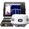
NSS12 Navigation Pack - NSS12, 3G Radar BSM-1
-
Max EN-M082 W28 River Danube-MAX
-
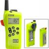
2828 SR203 GMDSS Survival Radio w/Replacable Lithium B
-
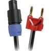
Skt 430BN 30 ft Speakon to Banana Speaker Cable
-
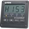
SP110VF-2 Autopilot with Virtual Feedback and 18CI Reversing PU
-
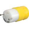
4731CR Female Connector 15A 125V
-
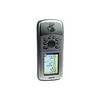
GPSMAP 76CSx - Marine, hiking GPS receiver - 2.6" color - 160 x 240
-
e7D 7 Multifunction W Sonar, Internal GPS - USA Silver Cha
-
CPN1010i 10 in. Networking GPS with WiFi Preloaded