GPSMAP 76CSx - Marine, hiking GPS receiver - 2.6" color - 160 x 240
Model: 76CSx Brand: Garmin
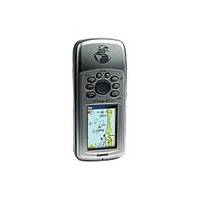
The GPSMAP 76CSx is a refreshing upgrade of the GPSMAP 76CS, one of the most popular Garmin's models for outdoor and marine use. This unit features a removable microSD card for detailed mapping memory and a waterproof, rugged housing. The microSD card slot is located inside the waterproof battery compartment. Users can load map data and transfer routes and waypoints through the unit's fast USB connection. In addition, this unit features a new, highly sensitive GPS receiver that acquires satellites faster and lets users track their location in challenging conditions, such as heavy foliage or deep canyons. The GPSMAP 76CSx also incorporates a barometric altimeter for extremely accurate elevation data and an electronic compass that displays an accurate heading while standing still. Considered the mainstay among serious outdoor enthusiasts, the GPSMAP 76CSx offers a large color TFT display and turn-by-turn routing capability. This unit also floats when dropped in the water. The unit comes with a blank 128 MB microSD card. « less
Product Specification
-
General
Product Type: GPS receiverRecommended Use: Marine, hikingPreloaded Maps: Europe, Africa, Middle East, Western RussiaReceiver: 12 channelCard Reader: microSDInterface: Serial, USB, NMEA 0183, RTCM SC-104 DGPSFunctions & Services: Electronic compass, elevation, MOB (Man Overboard), ascent/descent rateIncluded Software: MapSource Trip & Waypoint ManagerCompatible Software: MapSource BlueChart, MapSource US TOPO 24K, MapSource Fishing Hot Spots, MapSource Recreational Lakes, MapSource US TOPO, MapSource City NavigatorGrids: UTM, MGRS, Lat/Lon, User, Loran TDs, MaidenheadSBAS: WAASDGPS: DGPS readyAntenna: Built-inAccuracy: Position - 49 ft Position - 10 ft - 16 ft ( with DGPS ) Position - 10 ft ( with WAAS ) Velocity - 0.16 ft/secUpdate Rate: 1/secondInternal Memory: 115 MB flashFeatures: Barometric altimeterFirst Seen On Google Shopping: January 2006 -
Display
Type: LCD - colorDiagonal Size: 2.6"Resolution: 160 x 240Display Illumination: Yes -
Acquisition Times
Warm: 15 secCold: 45 sec -
Navigation
Waypoints: 1000Tracks: 20Tracklog Points: 10000Routes: 50Waypoints per route: 250Trip Computer: TracBack, average speed, maximum speed, trip timer, trip distance, sunrise/sunset times, sun/moon positions -
Connections
Interfaces: Serial - RS-232 Serial - USB Antenna - MCX -
Battery
Type: AA typeRequired Qty: 2Run Time (Up To): 20 hours -
Miscellaneous
Protection: WaterproofWaterproof Standard: IPX7Included Accessories: PC cable, lanyard, 128 MB microSD Card -
Dimensions & Weight
Width: 2.7 inDepth: 1.4 inHeight: 6.2 inWeight: 7.6 oz -
Environmental Parameters
Min Operating Temperature: 5 °FMax Operating Temperature: 158 °F -
Universal Product Identifiers
Part Numbers: 010-00469-00, 010-00469-01, 76CSxGTIN: 00753759057046, 07537590570468
Related Products
-
E62192 - A70D 6.4 Combo, Int GPS, w/o Charts
-
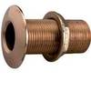
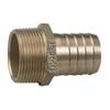
2" 2-3/8" 3-5/8" Perko Thru Hull Connection for Pipe
-
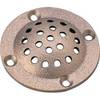
5" Round Bronze Strainer Made in The USA
-
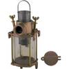
049300799C Transparent Cylinder F/0493007Plb
-
Pipe to Hose Adapter- Perko
-
Bulk cable - CAT 5e - Shielded twisted pair (STP) 1000 ft - Gray
-
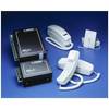
C-Phone Kit - Includes Master Control Unit, 2 Handset Kits & 100' of Wire
-
Network cable - CAT 6 - RJ-45 - M - Unshielded twisted pair (UTP) 10 ft - Black
-
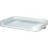
Bait Table W/Connector - White - TM00401
-
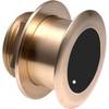
B175-20-L Broadband CHIRP, No CONNECTOR, Depth & Temperature Thru-Hull Tilted
-
5 Inch Power Mount with Light Mount Bracket Option PMF-5F-7L (PMF-57-M1 + ADA-R1) cpmf5f
-
GPSMAP 525 - Marine GPS receiver - 5" color - 640 x 480