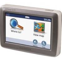
GPSMAP 620 - Marine Chartplotter - 5.2" color - 800 x 480
Model: 620 Brand: Garmin
Navigate by land and by sea with the Garmin GPSMAP 620. This full-featured marine chartplotter pulls double duty with an automotive mode that's ready to go as soon as you reach the shore. And to make sure you always know the way, the GPSMAP 620 comes standard with a high-sensitivity GPS receiver and brilliant, high-resolution touchscreen display. « less
Product Specification
-
General
Product Type: ChartplotterRecommended Use: MarineCard Reader: SD Memory CardInterface: NMEA 0183Voice: Voice command recognitionIncluded Software: Garmin Worldwide Marine BasemapCompatible Software: BlueChart g2 VisionAntenna: Built-inFeatures: Alarm, 2D / 3D map perspective, custom POIsFirst Seen On Google Shopping: October 2008 -
Display
Type: LCD - color - touch screenDiagonal Size: 5.2"Resolution: 800 x 480 -
Navigation
Waypoints: 1500Tracks: 20Tracklog Points: 10000Routes: 50Trip Computer: Sun/moon positions -
Connections
Interfaces: Antenna Headphones / line-out -
Battery
Type: Lithium ionRun Time (Up To): 9 hours -
Miscellaneous
Protection: WaterproofWaterproof Standard: IPX7Included Accessories: Protective cover, AC power adapter, USB cable -
Dimensions & Weight
Width: 5.9 inDepth: 1.9 inHeight: 4 inWeight: 17.3 oz -
Universal Product Identifiers
Part Numbers: 010-00696-00, 620GTIN: 00749856016963, 00753759083540
Related Products
-
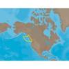
NA-M025 Max Wide C Card Canada West
-
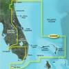
BlueChart g2 Vision - Jacksonville to Key West - Maps
-
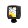
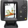
Fishfinder echo 500c - Fishfinder - included transducer - dual-beam
-
010-C0787-20 Bluechart G2 HXEU051RLista - Sognefjorden microSD
-
010-C0774-20 Bluechart G2 HXEU016RMediterranean Southeast
-
MT-403FFSVC Hydrostatic Release for MT-403FF & MT-403FG
-
500 Series 596c - Fishfinder - included transducer : XNT-9-20-T - dual-beam
-
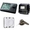
AP2804 Autopilot System AP28,AC42,RC42,RF300,RPU160
-
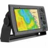
NavNet 3D Color 8.4" LCD Multifunction Display
-
5ft 28AWG High Speed HDMI Cable w/Ferrite cores - Black
-
100ft 24AWG Cat6 550mhz UTP Ethernet Bare Copper Network Cable - Blue
-
Marine Twisted-Pair Y-Adapter Cable - XMD-WHTAIC1M2F