010-C0774-20 Bluechart G2 HXEU016RMediterranean Southeast
Model: 010-C0774-20 Brand: Garmin
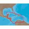
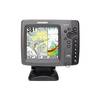
See your surroundings more clearly with BlueChart g2 data. With BlueChart g2, you'll get detailed marine cartography that provides convenient viewing of nautical content. BlueChart g2 allows you to see your vessel's precise, on-chart position in relation to naviads, coastal features, anchorages, obstructions, waterways, restricted areas and more. You will also have access to detailed mapping capabilities that include Safety Shading, Fishing Charts, smooth data transition between zoom levels, harmonious transition across chart borders, and reduction of chart discontinuities. Covers: From Gulluk, Turkey east to include Cyprus, Syria, Lebanon and Israel, then west to Misratah, Libya. « less
Product Specification
-
Universal Product Identifiers
Part Numbers: 010-C0774-20, 10805083, 35622GTIN: 00753759091729
Related Products
-
Motor/Sonar Connector Plug
-
Package(e97 with aus, NZ, S. America, Asia Chart, 4KW 24 Inch Digital Radome & Radar Cable)
-
NA-C502 Furuno FP Format Western Caribbean S
-
SA-C001 C-Card Format - Peru - P. Vallarta P. Bolivar
-
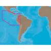
BlueChart g2 Vision - Southeast Caribbean - Maps
-
Fish-N-Map 8263; Map-Lake Shasta
-
All Around Light, Clear Nav Light Fresnel Lens Scotty
-
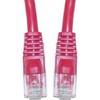
Cat6a Ethernet Cable | 3ft | Red | Network | 10 Gigabit
-
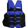
LJ-XXL - Adult Life Vest Size XXL
-
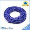
100ft 24AWG Cat6 550mhz UTP Ethernet Bare Copper Network Cable - Purple
-
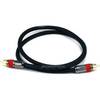
240-182 Digital Coaxial/Subwoofer Audio Cable 3 ft. CL2
-
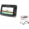
700 Series 788ci Combo - Marine Chartplotter - 5" color - 640 x 640