010-C0787-20 Bluechart G2 HXEU051RLista - Sognefjorden microSD
Model: 010-C0787-20 Brand: Garmin
See your surroundings more clearly with BlueChart g2 data. With BlueChart g2, you'll get detailed marine cartography that provides convenient viewing of nautical content. BlueChart g2 allows you to see your vessel's precise, on-chart position in relation to naviads, coastal features, anchorages, obstructions, waterways, restricted areas and more. You will also have access to detailed mapping capabilities that include Safety Shading, Fishing Charts, smooth data transition between zoom levels, harmonious transition across chart borders, and reduction of chart discontinuities. Covers: Detailed coverage of the Norway coast from Farsund to Sognefjorden, including the Shetland Islands. Includes detailed coverage of Bergen, Haugesund and Stavanger. « less
Product Specification
-
Universal Product Identifiers
Part Numbers: 010-C0787-20, 10805356, 35646GTIN: 00753759091965
Related Products
-
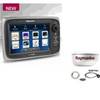
Package(e7 with aus, NZ, S. America, Asia Chart, 4KW 24 Inch Digital Radome & Radar Cable)
-
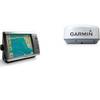
Radar 4012 Package with GMR18 4KW Radome
-
NT+ Wide Chart (americas) c11206
-
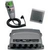
010-00756-00 VHF 300 Marine Radio
-
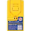
1066 Replacement Lithium Battery for 2726 and 2727
-
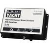
ZDIGAISNET AISnet AIS Base Station
-
NSE8 Navigation Pack - NSE8, GS15 & BR24
-
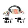
STP 803 - Audio cable kit - Male Phone stereo 6.3 mm to M Phone mono 6.3 mm
-
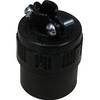
PHF1 Female Phone Connector
-
Pma6fo8l 6 Mount Wo Light Bar FFuruno
-
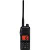
Hand Held VHF Radio HX280S
-
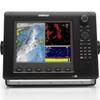
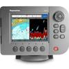
E62188-IN A57D GPS Chartplotter / Fishfinder