BlueChart g2 Vision - Southeast Florida - Maps
Model: Brand: Garmin
BlueChart g2 Vision offers the same rich detailed charting of BlueChart g2 to help you get the most out of your unit. In addition, g2 Vision features a growing database of high-resolution satellite imagery, above and below the water 3D perspective, auto guidance technology, aerial photographs for real world reference and coastal roads with points of interest. This product features data from explorer charts for the Bahamas! Vero Beach south to include Lake Okeechobee, Florida Keys, Dry Tortugas, and covering the west coast of Florida north to Naples. Also covered all the Bahamas, Andros Island, Eleuthera Island, Cat Island, Great Exuma Island, Little Exuma Island, and Hog Cay. « less
Product Specification
-
General
Product Type: MapsDistribution Media: SD Memory CardFirst Seen On Google Shopping: May 2007 -
Compatibility Information
Designed For: Garmin GPSMAP 4008, 4012, 420, 4208, 420s, 4212, 430, 430s, 430sx, 430x, 440, 440s, 440sx, 440x, 450, 5008, 5012, 520, 5208, 520s, 5212, 525, 525s, 530, 530s, 535, 535s, 540, 540s, 545, 545s, 550, 550s, 555, 555s -
Universal Product Identifiers
Part Numbers: 010-C0711-00, Southeast FloridaGTIN: 00753759068912
Related Products
-
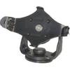
GPS receiver mount bracket
-
CP450C ClearPulse Chirp Sonar Sounder Module
-
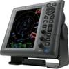
1935 10.4 Color LCD Radar with 3.5' Open Array
-
NA-C205 C-Card Format - Fundy Nova Scotia Pei Cape Br
-
20ft 24AWG Cat5e 350MHz UTP Bare Copper Ethernet Network Cable - Purple
-
Navigation Light All Round Pedestal Mount, White Lens
-
Practical Marine Navigation [Book]
-
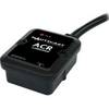
2675 Nauticast AIS Dual Channel Receiver
-
8ft 24AWG CL2 High Speed HDMI Cable w/ Net Jacket - Black
-
Phone Cable, RJ11 (6p4c), Reverse - 7ft for voice
-
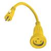
HBL61CM22 - Straight Marine Adapter, 5-15P, L5-30R
-
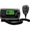
VHF 100 & 100i Fixed Mount Radios Radio, International 10198224