Marine Navigation Workbook: Piloting and Celestial and Electronic Navigation [Book]
The standard navigation textbook at the U.S. Naval Academy and NROTC college programs for twenty-five years, this highly regarded reference has trained more than two generations of students on the practice of marine navigation in the U.S. Navy. All aspects of the duties, practices, and responsibilities of the Navy surface navigator at sea are covered. Long praised for its clarity and thoroughness, the text has now been revised and updated to reflect the latest changes in marine navigation technology and government publications.In this fourth edition all sight forms reflect those now in use in the U.S. fleet. Also included is new summary information on currently available computer navigation applications programs and new information on world geodesy and global positioning systems. Appendixes present the most important pages of Chart No. 1 and selected tables from the American Practical Navigator (Bowditch).Also available is the Marine Navigation Workbook, a chapter-by-chapter compendium of supplemental,queries and problems designed to assist the student to master the material presented in the textbook -- complete with a handy three-ring binder. An appendix provides complete answers and solutions to all odd-numbered problems along with plotting sheets and forms. A new Instructor's Answer Key is available to bona fide instructors. « less
Product Specification
-
Authors: Cdr Richard R HobbsPages: 400Format: paperbackPublication Date: November 1, 1997Key Terms: Nautical Almanac, set and drift, sextant, daylight savings, Loran-C, Polaris, Fomalhaut, gyrocompass, nautical chart, Mercator chart, celestial navigation, celestial coordinate system, applications software, Celestial horizon, Achernar, LEARNING OBJECTIVES, Arcturus, Acrux, weather fronts, Tide Tables
-
Universal Product Identifiers
ISBN: 1557503850GTIN: 09781557503855
Related Products
-
LMB-F2 F/ Sitex Simrad et Al Domes
-
Max AN-M203 W51 Yellow Sea to Malaya-MAX
-
BlueChart g2 Vision - Aleutian Islands - Maps
-
Fishin' Buddy 140c - Fishfinder - portable - included transducer - single-beam
-
MapSource BlueChart - Americas - Maps
-
SP36-10 Autopilot W Rate Comp Virt Feedback
-
75ft 24AWG Cat5e 350MHz UTP Bare Copper Ethernet Network Cable - Green
-
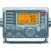
M504A 53 M504 Gray VHF - Rear Mic Version
-
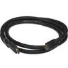
5ft 24AWG CL2 High Speed HDMI Cable w/ Net Jacket - Black
-
50HM1 50 Amp - 125/250VAC Male Plug
-
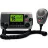
34170 Vhf-200 VHF Radio W/class-d DSC
-
Eclipse GX1150W Class-D VHF Radio (White)