BlueChart g2 Vision - Aleutian Islands - Maps
Model: Brand: Garmin
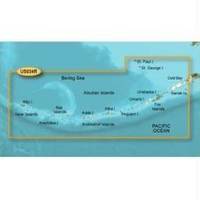
BlueChart g2 Vision offers the same rich detailed charting of BlueChart g2 to help you get the most out of your unit. In addition, g2 Vision features a growing database of high-resolution satellite imagery, above and below the water 3D perspective, auto guidance technology, aerial photographs for real world reference and coastal roads with points of interest. This product features coverage of the Aleutian Islands from Attu Island to Cold Bay, including Adak Station and Unalaska. Also covers the Pribilof Islands, including St. Paul Island and St. George Island. « less
Product Specification
-
General
Product Type: MapsDistribution Media: SD Memory CardFirst Seen On Google Shopping: June 2007 -
Compatibility Information
Designed For: Garmin GPSMAP 4008, 4012, 420, 4208, 420s, 4212, 430, 430s, 430sx, 430x, 440, 440s, 440sx, 440x, 450, 5008, 5012, 520, 5208, 520s, 5212, 525, 525s, 530, 530s, 535, 535s, 540, 540s, 545, 545s, 550, 550s, 555, 555s -
Universal Product Identifiers
Part Numbers: 010-C0735-00, Aleutian Islands
Related Products
-
CH250BB/60/340 60 kHz Black Box Searchlight Sonar System. Includes 400mm Travel Hoist and Operates at 24 & 32VDC
-
5209; Map-Roosevelt Lake
-
The Nautical Chart: A Novel of Adventure [Book]
-
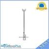
PLB-CE3 Ceiling Bracket for 30inch Above TV (To Be Used with PID 2852, 3003, or 3004)
-
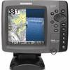
788ci HD Di Combo Down Imaging w/TM Transducer
-
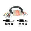
STP 803 - Audio cable kit - Male Phone stereo 6.3 mm to M Phone mono 6.3 mm
-
Idc34 x 4 / CE34 x 2, 46 Inch Floppy Cable 2104-646
-
1.5ft Premier Series XLR Female to 1/4inch TRS Male 16AWG
-
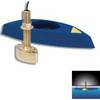
B45-DT-10N 600W Thru-Hull Transducer Northstar 10-Pin Connector
-
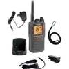
MRHH325VP VHF Two-way radio
-
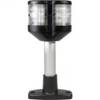
Series 2010 Combo Masthead/All Round Lamp Fixed Mount, 4 Inch, 995003001
-
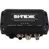
MDA-1 Metadata Class B AIS Transceiver W Internal GPS