BlueChart g2 Vision - Southeast Caribbean - Maps
Model: Brand: Garmin
BlueChart g2 Vision offers the same rich detailed charting of BlueChart g2 to help you get the most out of your unit. In addition, g2 Vision features a growing database of high-resolution satellite imagery, above and below the water 3D perspective, auto guidance technology, aerial photographs for real world reference and coastal roads with points of interest. This product features coverage of the Caribbean from Haiti to Trinidad & Tobago, including Puerto Rico and all of the Lesser Antilles. Also includes the Colombian and Venezuelan coasts from Barranquilla, Colombia to the mouth of the Orinoco River, including Lake Maracaibo and the Gulf of Paria. « less
Product Specification
-
General
Product Type: MapsDistribution Media: SD Memory CardFirst Seen On Google Shopping: May 2007 -
Compatibility Information
Designed For: Garmin GPSMAP 4008, 4012, 420, 4208, 420s, 4212, 430, 430s, 430sx, 430x, 440, 440s, 440sx, 440x, 450, 5008, 5012, 520, 5208, 520s, 5212, 525, 525s, 530, 530s, 535, 535s, 540, 540s, 545, 545s, 550, 550s, 555, 555s -
Universal Product Identifiers
Part Numbers: 010-C0731-00, Southeast CaribbeanGTIN: 00753759069117, 00881094458805
Related Products
-
AP2801VRF Autopilot AP28,AC12,RC42,NO Drive
-
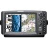
C97 Multifunction 9" Display with Sonar - US Inland Charts T70027 c44325
-
BR24 Broadband Radar 10M Cable for HDS-Series #AA010214
-
4263541 Repl. Cigarette/Chart Lighter
-
010-C0797-10 Bluechart G2 HEU453SAdriatic Sea South Coast
-
010-C1024-20 Bluechart G2 HXUS401SBermuda Microsd/sd Adaptor
-
AP50 02 Autopilot System - AP50 2 Autopilot
-
5500 Series LED All Around Navigation Lights 54" Straight Pole
-
NMEA1 Trim Tab Indicator Kit, NMEA
-
A5030S 125VAC - 50 Amp -to- 125VAC - 30 Amp Straight ad
-
HBL105GF 15A Female to 30A Male W GFCI Protection
-
408720-1 998c HD Si Combo