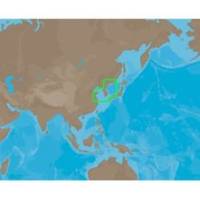
AN-M203 SD Card Format Yellow Sea & Malaya
Model: AN-M203 Brand: C-Map
Coverage of Yellow Sea to Malaya cover's Jiatiao Port - Xiangshan Harbour - Zhoushan City - Qantangjiang River Mouth - Zhoushan Archipelago - Yangtze River - Doulong Harbour Entrance - She-Yang River Mouth - Guan River Mouth - Lianyungang Port - Lanshan Harbour - Rizao Harbour - Quingao Port - Aoshan Port - Nudao Port - Entrance to Dingzi River - Jinghai Bay - Shidao Bay - Rongcheng Bay - Weihat Bay - Yantai Port - Penglari Port - Sanshan Head - Xiaoqinghe Mouth - Dongying Port - Tao Er River Entrance - Tianjing Port - Quinhuangdao Port - Pulanddian Bay - Dalian Bay - Changshan Archipelago - Shicheng Island - Dadong Port - Nampo Hang - Daesan Hang - Gyema Hang - Sinyang Port - T Aepaek - Zaliv Pos Yeta - Zaliv Nakhodka - Wakamatsu Island - Omura Wan - Matsuura Ko - Iki Island - Kita-kyushi - Seto Naikai - Komatsu and Toyama. « less
Product Specification
-
Universal Product Identifiers
Part Number: AN-M203SDCARD
Related Products
-
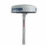
Radar Pole Mount 6' Kit for Garmin/Furuno Domes 36177
-
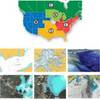
CFHMPTN6 HotMaps Platinum Multi-Dimensional 3D Lake Maps
-
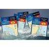
Waterproof Chart Kit - Cape Cod to Cape Ann, Mass #WPB0240
-
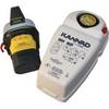
K1202367 Safelink Automatic EPIRB w/GPS - Category 1 w/Housing
-
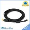
15ft USB 2.0 A Male to Mini-B 5pin Male 28/24AWG Cable w/ Ferrite Core (Gold Plated)
-
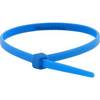
Cable Tie 4 Inch 18LBS, 100pcs/Pack - Blue
-
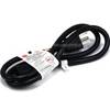
3ft 16AWG Power Cord Cable w/ 3 Conductor PC Power Connector Socket (C13/5-15P) - Black
-
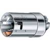
63CM61 Male Plug for 50 AMP/125 Volt
-
ELB-NM-NF Mini 90 Deg. Male to Female Connector
-
Marine Products Plug Wire Set 9-28043
-
SS264W - 50kHz - 20 Deg - 6 Pin Garmin Connector
-
Yellow Six Inch Category 5 Enhanced Cat 5e Ethernet Network Cable .5