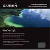
BlueChart g2 Vision - Bretagne - Maps
Model: Brand: Garmin
BlueChart g2 Vision offers the same rich detailed charting of BlueChart g2 to help you get the most out of your unit. In addition, g2 Vision features a growing database of high-resolution satellite imagery, above and below the water 3D perspective, auto guidance technology, aerial photographs for real world reference and coastal roads with points of interest. This product features detailed coverage from Saint-Vaast-la-Hougue to Le Croisic and Belle-Ile, including Cherbourg, the Channel Islands, Saint-Malo, Brest, and Lorient. « less
Product Specification
-
General
Product Type: MapsDistribution Media: SD Memory CardFirst Seen On Google Shopping: June 2007 -
Compatibility Information
Designed For: Garmin GPSMAP 4008, 4012, 420, 4208, 420s, 4212, 430, 430s, 430sx, 430x, 440, 440s, 440sx, 440x, 450, 5008, 5012, 520, 5208, 520s, 5212, 525, 525s, 530, 530s, 535, 535s, 540, 540s, 545, 545s, 550, 550s, 555, 555s -
Universal Product Identifiers
Part Numbers: 010-C0801-00, BretagneGTIN: 00753759069810
Related Products
-
AIT1000 Class B Transponder w/GPS Antenna Incl
-
C127 Multifunction 12" Display with Sonar - aus, NZ, S. America, Asia Charts T70035 c44335
-
Marine HM195 Commandmic IV - HM195 Mic
-
010-C0731-20 Bluechart G2 HXUS030RSoutheast Caribbean microSD
-
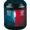
Navigation Light for Bulk Head Mounting , Starboard
-
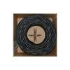
Bulk cable - CAT 6 - Unshielded twisted pair (UTP) 1000 ft - Black
-
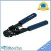
High Quality 8P8C RJ-45 Network Cable Crimper [HT-210C]
-
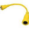
HBL61CM56 Adapter 50A 12V Female to 30A Male
-
CP-12L Cigarette Light Adapter for M3A/M2A c10195
-
Terk Sirmarine Satellite Radio Antenna
-
408930-1 Ice 597ci HD Combo
-
FishElite 480 - Marine Chartplotter - 5" monochrome - 480 x 480