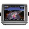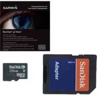
BlueChart g2 Vision - Anchorage to Juneau - Maps
Model: Brand: Garmin
BlueChart g2 Vision offers the same rich detailed charting of BlueChart g2 to help you get the most out of your unit. In addition, g2 Vision features a growing database of high-resolution satellite imagery, above and below the water 3D perspective, auto guidance technology, aerial photographs for real world reference and coastal roads with points of interest. This product features detailed coverage from Juneau to Alinchak Bay includes Kodiak Island, Cook Inlet, Prince William Sound, Yakutat, Glacier Bay and Icy Strait. « less
Product Specification
-
General
Distribution Media: SD Memory CardFirst Seen On Google Shopping: May 2007Product Type: Maps -
Compatibility Information
Designed For: Garmin GPSMAP 4008, 4012, 420, 4208, 420s, 4212, 430, 430s, 430sx, 430x, 440, 440s, 440sx, 440x, 450, 5008, 5012, 520, 5208, 520s, 5212, 525, 525s, 530, 530s, 535, 535s, 540, 540s, 545, 545s, 550, 550s, 555, 555s -
Universal Product Identifiers
Part Numbers: 010-C0726-00, Anchorage to JuneauGTIN: 00753759069063
Related Products
-
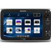
T70057 E127 Multifunction Display w/Sonar - US Inland Charts
-
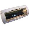
SG1 Marine Weatherproof CD Player Face Cover
-
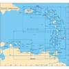
A27 Imray Antigua Marine Nautical Chart
-
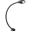
Marine Flexible LED Chart Table Lamp 9353723
-
010-00749-01 - GPSMAP 7212, 12 Tchscrn MFD, Coast Map
-
LED Stern Transom Mount Black ASL-335027
-
Adjustable Tilting/Swiveling Wall Mount Bracket for LCD LED Plasma Corner Friendly (Max 110Lbs, 32~50inch) - Black
-
10ft 24AWG Cat6 550mhz UTP Ethernet Bare Copper Network Cable - White
-
6ft DB-25(IEEE-1284) Male to Mini/Micro Centronic 36(hpcn36) Male Cable [IE]
-
M504 Black VHF Rear Mic Version
-
Matrix 97 Sonar - Fishfinder - included transducer : XNT-9-20-T - dual-beam
-
300 Series 383c Combo - Marine Chartplotter - 3" color - 240 x 320