8264; Map-Clearlake/Lake Berryessa
Model: 8264 Brand: Fish-n-Map
FISH-N-MAP UNDERWATER TOPOGRAPHY MAPSMade of waterproof, tear resistant plastic. Features include: underwater depth contours, fish locations, latitude and longitude for GPS, multiple freshwater lakes on one map, boat ramps, recreational facilities and much more.
Product Specification
-
Universal Product Identifiers
Part Numbers: 235450, 8264, MSI432211GTIN: 00761428082640
Related Products
-
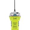
2848.0 Globalfix iPro 406 MHz GPS EPIRB - Category 2
-
NAM022C C-Card US East COAST/BAHAMAS
-
Mini CDC Chart F/ 1650-1850
-
EW-C207 C-Card Format Bristol Channel & Irish Sea
-
Max AU-M222 W63 New Zealand Chatham-MAX
-
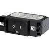
7404 20A Flat Rocker Circuit Breaker SC1
-
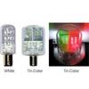
Navigation Light BAY15d Replacement Bulb 9353384
-
Marine navigation instruments [Book]
-
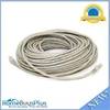
100ft 24AWG Cat6 500mhz Crossover Ethernet Bare Copper Network Cable - Gray
-
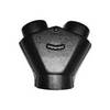
Marine Systems Inc AY665 Adapter - 6x6x5 ''Y''
-
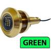
Lumishore Thru Hull Flush Fit 18 Watt Green Underwater Light 41681
-
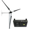
Whisper Marine Wind Turbine Whi-200 Marine with Controller