010-C1020-10 Bluechart G2 HPC024RAustralia & New Zealand Data
Model: 010-C1020-10 Brand: Garmin
See your surroundings more clearly with BlueChart g2 data. With BlueChart g2, you'll get detailed marine cartography that provides convenient viewing of nautical content. BlueChart g2 allows you to see your vessel's precise, on-chart position in relation to naviads, coastal features, anchorages, obstructions, waterways, restricted areas and more. You will also have access to detailed mapping capabilities that include Safety Shading, Fishing Charts, smooth data transition between zoom levels, harmonious transition across chart borders, and reduction of chart discontinuities. Covers: Detailed coverage of the entire continent of Australia and New Zealand. Coverage includes Brisbane, Sydney, and the Great Barrier Reef along the Eastern coast. Coverage continues along the Southern coast including Melbourne, Adelaide, and Tasmania through the Great Australian Bight. Coverage also includes Perth, Geraldton, Darwin, and the Gulf of Carpentaria on the Western and Northern coasts. « less
Product Specification
-
Universal Product Identifiers
Part Numbers: 010-C1020-10, 10807220, 35813GTIN: 00753759095482
Related Products
-
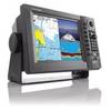
MDS-9 4KW 24 Inch Dome Black Box Radar with 10 Meter Cable wmds9
-
1964CNT NavNet VX2 10.4quot;COLOR Disp 25KW Gearbox
-
Description of a New Improved Chart of the Islands of Shetland to Which Are Annexed Three Copper Plates and a Special Chart of Valey-Sound, Published from the Royal Danish Marine Archives for Draughts and Charts by P. de Lowenorn, 1787. [Book]
-
WPC025; Upper Chesapeake Bay
-
Popular Atlases, Gulf Islands Atlas Canadian Charts
-
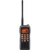
Hx850s Two-Way Radio,marine,5 Watts 4lpr5
-
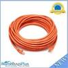
50ft 24AWG Cat6 550mhz UTP Ethernet Bare Copper Network Cable - Orange
-
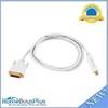
6ft 32AWG Mini DisplayPort to DVI Cable - White
-
25ft DB-25(IEEE-1284) Male to Mini/Micro Centronic 36(hpcn36) Male Cable [IE]
-
Cat6a Ethernet Cable | 5ft | White | Network | 10 Gigabit
-
Marine Products Plug Wire Set 9-28033
-
42-Pieces Heat Shrink Connector Kit BR51059