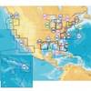
010-C0738-20 Bluechart G2 HXUS400SWalkers Cay to Exuma Sound
Model: 010-C0738-20 Brand: Garmin
Garmin Bluechart G2 HXUS400S - Walkers Cay to Exuma Sound - Micro SD & SD HXUS400S Covers: Detailed coverage of the Bahamas and the coast of Florida from Fort Pierce to Long Key. Also includes detailed coverage of Grand Bahama Island, Great Abaco Island, Eleuthera Island, and Andros Island. « less
Product Specification
-
Universal Product Identifiers
Part Numbers: 010-C0738-20, 10470037, 35568, CW-35568, GAR010C073820GTIN: 00753759089481
Related Products
-
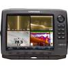
42990 HDS-10 Gen2 Insight USA 83/200kHz
-
HD & Super Digital Radar Scanner Cables 25M Pedestal
-
CF/673P+ Platinum Plus Maine on CF
-
100ft 18AWG CL2 Rated 2-Conductor Loud Speaker Cable (for
-
3ft Premium Optical Toslink Cable w/ Metal Fancy Connector
-
Vanco Installer Series High Speed - Video / audio / network cable - Male 19 pin HDMI Type A to M 19 pin HDMI Type A
-
3ft 32AWG Mini DisplayPort Male to Female Extension Cable - White
-
6ft 24AWG CL2 Silver Plated High Speed HDMI Cable - Black
-
2003 3/8 in. Power Post
-
Marine Cowl Vent w/Hose Adapter f/4 BEC-C8
-
Ltb Top - Universal Box Top for All Round, Masthead & Stern Lights LTB-BOX
-
HX471 VHF Radio, 5W Submersible Tri Band HH Silver