010-C0762-10 Bluechart G2 HEU003RGreat Britain Northeast
Model: 010-C0762-10 Brand: Garmin
Covers from the Isle of Lewis, Scotland to Bridlington Harbour, England, including Gairloch, the Shetland Islands, Edinburgh, and North Sea offshore charts. Also includes the Caledonian Canal, Loch Linnhe, and Loch Ness. See your surroundings more clearly with BlueChart g2 data. With BlueChart g2, you'll get detailed marine cartography that provides convenient viewing of nautical content. BlueChart g2 allows you to see your vessel's precise, on-chart position in relation to naviads, coastal features, anchorages, obstructions, waterways, restricted areas and more. You will also have access to detailed mapping capabilities that include Safety Shading , Fishing Charts , smooth data transition between zoom levels, harmonious transition across chart borders, and reduction of chart discontinuities. « less
Product Specification
-
Universal Product Identifiers
Part Numbers: 010-C0762-10, 10804805, 35597GTIN: 00753759091477
Related Products
-
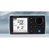
NAVPILOT 700OB Autopilot for Outboard without Pumpset
-
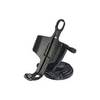
Marine Mount - GPS receiver mount bracket
-
Package(e125 with aus, NZ, S. America, Asia Chart, 4KW 24 Inch Digital Radome & Radar Cable)
-
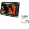
Radar 4012 Package with GMR18 4KW Radome
-
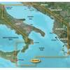
BlueChart g2 Vision - Adriatic Sea, South Coast - Maps
-
8001566 Navigation Light LED Replacement Bulbs: Festoon Star
-
100ft 24AWG Cat6 550mhz UTP Ethernet Bare Copper Network Cable - Black
-
Serial cable - (DB-9) - F - 25 ft - PC
-
DCE/DTE DB60 Crossover Cable - 1ft
-
30ft 24AWG Cat6 550mhz UTP Ethernet Bare Copper Network 5017
-
T. H. Marine Conn Thruhul Blk Straight ThruHull Connectors TH1200D
-
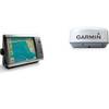
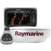
T70103 e7D 7" Multifunction Display w/Sonar, Internal G