Waterproof Chart Kit - Cape Cod to Cape Ann, Mass #WPB0240
Model: WPB0240 Brand: Maptech
Waterproof Charts w/ Companion CD WPB0240 240: Cape Cod to Cape Ann, Mass Cape Cod Bay, Massachusetts Bay, and Boston Harbor, 26 chart pages, 116 GPS waypoints, Lat. /Long. grids, pre-plotted courses, ramps, and 200 marine facilities. 12 x 17, scales 1:400,000 to 1:12,500. Product Overview These easy-to-use, compact chart books are ideal for Day-Sailors, Fishing Boats, and Trailer Boats. They measure 12 x 17 (24 x 17 when open) and are made of waterproof, tear-resistant synthetic paper that will withstand the elements. GPS Ready New features make Waterproof Chartbooks easy to use with your GPS. Most charts include one-minute lat./long. grids to make vessel positioning a breeze, and major navigation aids are identified with named GPS waypoints. Small and Large-Scale Charts Waterproof Chartbooks include small-scale, wide area charts as well as large-scale, detailed charts of harbors and approaches « less
Product Specification
-
Universal Product Identifiers
Part Number: WPB0240
Related Products
-
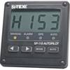
Scp 110 Autopilot Course Computer Rate Gyro
-
AP2402VRF Autopilot AP24,AC42,RC42,NO Drive
-
010-11417-00 - Heading Sensor (fluxgate Compass)
-
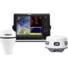
000-10345-002 - NSE12 Navigation Pack w/ 3G Radar
-
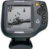
500 Series 525 - Fishfinder - included transducer : XNT-9-20-T - single-beam
-
SP110RF-3 System with Rudder Feedback and Type S Mechanical Das
-
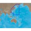
AN-M001 SD Card Format East China Sea & Kamchatka
-
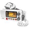
UM415 VHF Fixed Radio 38460
-
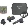
Auto Pilot S1g/St8001 Inboard E12121
-
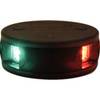
LED Bicolor Light Black 12V/24V ASL-341007
-
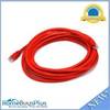
14ft 24AWG Cat6 550mhz UTP Ethernet Bare Copper Network Cable - Red
-
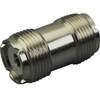
329950-1 UHF Dbl Female Connector