Understanding a Nautical Chart: A Practical Guide to Safe Navigation [Book]
A handy guide to making sense of a nautical chartWhether they are paper or electronic, charts are the most fundamental navigational tool. Making the best use of them requires a great understanding of symbols and abbreviations, as well as an awareness of the limits of accuracy in positions and soundings. Understanding a Nautical Chart not only helps you to read a chart, it allows you to understand that information and use it to navigate safely. Learning the abbreviations and symbols are critical to anybody using a chart and before you can use one, you must know them or at have easy access to the definitions, all of which are included in a full copy of the key to UKHO charts (Chart 5011).Explains how to establish the accuracy of charts to allow you to navigate with confidence and safety Written by a former Royal Navy Deputy Commander in Chief, Paul BoissierIncludes a full copy of the key to UKHO chart symbols (Chart 5011). The chart information included is presented in the following sections: General Chart Number, Title, Marginal Notes, Positions, Distances, Directions, Compass Topography Natural Features, Cultural Features, Landmarks, Ports, Topographic Terms HydrographyTides, Currents, Depths, Nature of the Seabed, Rocks, Wrecks, Obstructions, Offshore Installations, Tracks, Routes Areas, Limits, Hydrographic Terms Aids and ServicesLights, Buoys, Beacons, Fog Signals, Radar, Radio, Electronic Position-Fixing Systems, Services, Small Craft Facilities Alphabetical IndexIndex of Abbreviations, International Abbreviations, List of Descriptors, IALA Maritime Buoyage System Chart 5011 About the author: Paul Boissier has spent much of his professional life at sea and was a senior admiral in the Royal Navy. He is also a very experienced yachtsman and has cruised extensively. These perspectives make him the ideal author this guide. Paul is now the chief executive of the RNLI (Royal National Lifeboat Institution), the charity that saves lives at sea and operates over 340 lifeboats around the UK and the Republic of Ireland. « less
Product Specification
-
Authors: Paul BoissierPages: 200Format: paperbackPublication Date: June 21, 2011
-
Universal Product Identifiers
ISBN: 047074913XGTIN: 09780470749135
Related Products
-
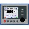
Admiral Color Display with SSRC1 Rate Gyro Compass & Rotary Feedback 10110037
-
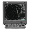
JMA-5322-9 Radar 96 NM with 9' Open Array & 19 Inch LCD Monitor
-
BlueChart g2 Vision - Anchorage to Juneau - Maps
-
343720122 3720 Series Multivolt White 16 9-31v
-
010-C0763-20 Bluechart G2 HXEU004RIrish Sea Microsd/sd Adaptor
-
Kwik Tek Life Jacket Bag, 4 Adult
-
Inline Valve, 1 1/2 Inch Pipe
-
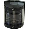
Classic Stern Light Black, Series 25 25500-7
-
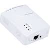
Ethernet Over Power Adapter (Pair) - 200Mbps
-
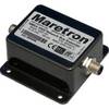
NBE100-01 NMEA 2000 Network Bus Extender
-
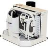
FCF-16000 Feel Cool Fast Marine Air Conditioner by Webasto
-
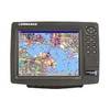
GlobalMap 9200C - Marine GPS receiver - 10.4" color - 600 x 800