010-C0765-10 Bluechart G2 HEU006RScotland West Coast Data
Model: 010-C0765-10 Brand: Garmin
See More of Your Surroundings See your surroundings more clearly with BlueChart g2 data. With BlueChart g2, you ll get detailed marine cartography that provides convenient viewing of nautical content. BlueChart g2 allows you to see your vessel s precise, on-chart position in relation to navaids, coastal features, anchorages, obstructions, waterways, restricted areas and more. You will also have access to detailed mapping capabilities that include Safety Shading , Fishing Charts , smooth data transition between zoom levels, harmonious transition across chart borders, and reduction of chart discontinuities. Realistic navigation features showing everything from shaded depth contours and coastlines to spot soundings, navaids, port plans, wrecks, obstructions, intertidal zones, restricted areas, IALA symbols and more. Smooth display presentation including seamless transitioning between zoom levels and more continuity across chart boundaries. Safety Shading allows user to enable contour shading for all depth contours shallower than user-defined safe depth. Fishing charts to help scope out bottom contours and depth soundings with less visual clutter on the display. Choice of standard 2-D direct overhead or 3-D "over the bow" map perspective to make chart reading and orientation easier. Compatible with HomePort - software that lets you use BlueChart data to conveniently plan and organize routes from your computer before your trip. « less
Product Specification
-
Universal Product Identifiers
Part Numbers: 010-C0765-10, 10804888, 35603GTIN: 00753759091538
Related Products
-
99-001 Hds5i-bndl, Hds-5, Fishfinder
-
LRA2400 HD Digital 4KW 24 Inch Radar Dome w12109
-
000-10239-001 Zeus Sailing Navigation System - 8" Display
-
00010777001 HDS-12 Touch G2 Insight 50/200
-
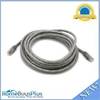
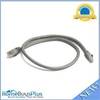
14ft 24AWG Cat6 550mhz UTP Ethernet Bare Copper Network Cable - Gray
-
Filters 85-1350 Vent Kit Marine, 1/2 Flange
-
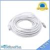
50ft 24AWG Cat5e 350MHz UTP Bare Copper Ethernet Network Cable - White
-
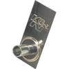
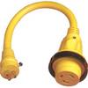
104SPP 30amp/125v Adapter Power
-
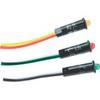
LED Red 11/64" 120VAC
-
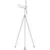
Mounting Kit for Wind Turbines - Marine Applications, Model#
-
2ft 24AWG Cat6 550mhz UTP Ethernet Bare Copper Network Cable - Gray
-
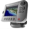
E62190-US - A70 6.4 Chartplotter, US Maps, Int GPS