The sea chart: the illustrated history of nautical maps and navigational charts [Book]
This book examines the history of the sea chart in both aesthetic and scientific terms. Chapters are organized along chronological and geographical lines. Each one opens with a succinct history of the charting of a particular area, and is followed by a sumptuous plate section of significant charts that support the text. Stand alone feature boxes explain key figures and themes.What makes this book so impressive is the selection of charts that the author, John Blake, has carefully gathered together from some of the most important archives in the world. The collection includes the early portolan charts of the fifteenth century, original manuscript charts of Europe, India and the Orient, and nautical maps that show the medieval view of the known world.This volume features examples from famous sets of charts, such as The Mariner's Mirrour, the English translation of the celebrated Spieghel der Zeevaerdt, Dell' Arcano del Mare, Le Neptune Francois, and the Atlantic Neptune, together with rare examples of individual charts, such as Benjamin Franklin's Chart of the North Atlantic. « less
Product Specification
-
Authors: John Blake (Lieutenant Commander.), John BlakePages: 160Format: bookPublication Date: June 28, 2004Key Terms: British Crown Copyright, portolan chart, rhumb lines, Admiralty, Pepys Library, Spice Islands, Alexander Dalrymple, Royal Geographical Society, Australia, compass rose, Portuguese, Cape Horn, James Cook, HMS Discovery, Francis Beaufort, North America, George Vancouver, Royal Navy, Samuel Wallis, Weddell Sea
-
Universal Product Identifiers
ISBN: 085177945XGTIN: 09780851779454
Related Products
-
AS-M206 SD Card Format Java and Indonesia
-
Mr F75 Fixed Mount Marine VHF Transceiver with Tri-Watch and Pa Capability - White, MRF75
-
2828 SR203 GMDSS Survival Radio w/Replacable Lithium B
-
HX751 6W Floating Handheld VHF Radio
-
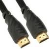
2841 25ft 26AWG CL2 Standard HDMI Cable - Black
-
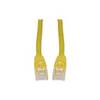
Patch cable - CAT 5e - RJ-45 - M - Unshielded twisted pair (UTP) 25 ft - Yellow
-
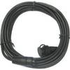
OPC-1000 20' Cable
-
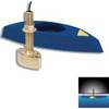
B45-DT-BL 600W Thru-Hull Transducer Lowrance 7-Pin Blue Connector
-
Air Breeze 1-ARBM-15-48 Marine Wind Generator 48VDC
-
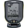
PiranhaMAX 215 - Fishfinder - included transducer : XNT-9-20-T - dual-beam
-
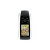
GPSMAP 78 - Marine, hiking GPS receiver - 2.6" color - 160 x 240
-
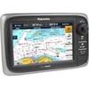
T70003 - E7, 7 GPS/MFD, US Inland Charts