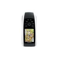
GPSMAP 78 - Marine, hiking GPS receiver - 2.6" color - 160 x 240
Model: 160 Brand: Garmin
For boaters and watersports enthusiasts who want to run with the best, the rugged GPSMAP 78 features crisp color mapping, high-sensitivity receiver, rubber side grips, plus a microSD card slot for loading additional maps. And it floats!
Product Specification
-
General
Product Type: GPS receiverRecommended Use: Marine, hikingPreloaded Maps: Australia, New ZealandCard Reader: microSDInterface: USB, NMEA 0183Functions & Services: Tide TabCompatible Software: MapSource City Navigator, MapSource BlueChart g2SBAS: WAASAntenna: Built-inInternal Memory: 1.7 GB flashFeatures: Custom POIs, automatic routing, hunt/fish calendar, Garmin HotFix, Geocaching, photo navigation, Garmin Connect compatibleFirst Seen On Google Shopping: May 2010 -
Display
Type: LCD - colorDiagonal Size: 2.6"Resolution: 160 x 240Display Illumination: YesFeatures: Transflective -
Navigation
Waypoints: 2000Tracks: 200Tracklog Points: 10000Routes: 200Trip Computer: Sun/moon positions -
Battery
Type: AA typeRequired Qty: 2Run Time (Up To): 20 hours -
Miscellaneous
Design Features: Rugged caseProtection: WaterproofWaterproof Standard: IPX7Included Accessories: Wrist strap, USB cable -
Dimensions & Weight
Width: 2.6 inDepth: 1.2 inHeight: 6 inWeight: 7.7 oz -
Universal Product Identifiers
Part Numbers: 010-00864-00, 78GTIN: 00050904807700, 00753759100902
Related Products
-
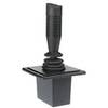
Autopilot Joy Stick E12136 c15658
-
SG1 Marine Weatherproof CD Player Face Cover
-
GMR40X XHD 4KW Radar Pedestal W/Cable Reman Noh
-
Max RS-M202 W36 Russian Federation NW-MAX
-
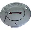
Deck Plates, Fills for Pipe, 2", Unmarked, Bronze
-
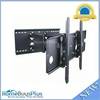
Adjustable Tilting/Swiveling Wall Mount Bracket for LCD LED Plasma (Max 175lbs, 32~60inch) (REV.2.0)
-
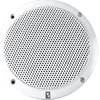
4 Inch 2-Way Coax Integral Grill Marine Speaker - (Pair) White c11221
-
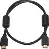
3ft 28AWG High Speed HDMI Cable w/Ferrite cores - Black
-
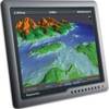
G170 17 Inch Ultra Bright Marine Display E02036
-
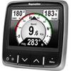
E22172 i70 Multifunction Instrument Display
-
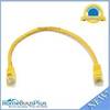
1ft 24AWG Cat5e 350MHz UTP Bare Copper Ethernet Network Cable - Yellow
-
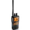
Marine Radio Two Way VHF