PAPR03; Region 3 Paper Chart Kit
Model: PAPR03 Brand: Maptech
ChartKits are full-color reproductions of U.S. government and private charts spiral bound into popular cruising regions with aerial photos, pre-plotted courses and more. The convenient-sized books are large enough to allow for manual plotting, yet small enough to sit on your nav-station or lap. Waterproof covers are available. « less
Product Specification
-
Universal Product Identifiers
Part Number: PAPR03
Related Products
-
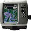
0100077300 Gpsmap536 Plotter
-
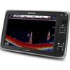
E127 Multifunction 12" Display with Sonar - US Inland Charts T70057 c44354
-
010-C0765-10 Bluechart G2 HEU006RScotland West Coast Data
-
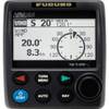
NAVPILOT 711 High-Performance, Universal Autopilot Package
-
1ft 24AWG Cat5e 350MHz UTP Bare Copper Ethernet Network Cable - Purple
-
2669 50ft Optical Toslink 5.0mm OD Audio Cable
-
6ft USB A to Mini-B 5pin 28/28AWG Cable
-
136-05 B744V Bronz Thru Hull
-
6ft A to Mini-B 8pin USB Cable w/ Ferrites for Nikon Coolpix
-
10ft 32AWG Mini DisplayPort | Thunderbolt to VGA Cable - White
-
Network cable - CAT 6 - RJ-45 - M - Unshielded twisted pair (UTP) 75 ft - Black
-
HS5 SeaTalk hs Network Switch, A80007 c44691