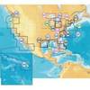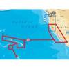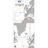
NT+ Wide Chart (New Zealand & Australian & Asia Region)
Model: Brand: C-Map
Cmap Chartplotter Compatibility Indian Ocean & Asia (W) Oceania (W) NT+ is the "next generation" of C-MAP electronic charts, featuring much wider coverage areas at substantially lower prices. NT+ C-card technology is reverse-compatible with current NT charting systems. Full benefits of improved chart display are optimized on systems Designed for NT+ (or by updating your NT system software to NT+). Vastly Expanded Coverage: Important advances in technology now permit C-MAP to offer significantly increased coverage areas without sacrificing compatibility or performance with current C-card based navigating systems. This has, in turn, resulted in much more coverage at a much lower cost! Extra Information Not Found On Official Government Charts: True Color NavAids - Extensive NavAid information, allowing for on-screen display in true shapes and colors. Port Info - Complete and detailed databases of port facilities, services and contact information. Tide Info - NT+ C-cards include primary and secondary tidal stations that can be queried for easy access while navigating. Easy-to-read graphs display depth at high and low water for sun-up and sun-down. Tidal predictions make travel planning easier and safer. Improved Chart Display: Paper Chart Appearance - All the advantages of electronic charts with the familiar look of a paper chart. C-MAP's experience with professional navigation and highly effective chart display has resulted in a new chart look for NT+. This new look makes creative use of colors, patterns and icons to increase the familiarity and usability of the content-rich NT+ database. New NavAid Symbols and Styles - Depending upon navigation situations and mariner's preference, Aids to Navigation can now be configured for three basic styles: INTERNATIONAL - NavAids shown in real life shapes and colors for quick visual recognition (as per official paper chart presentations). UNITED STATES - NavAids shown in simplified shapes and real colors (as generally found on NOAA paper charts). SIMPLIFIED - NavAids shown in generic symbols for minimum visual clutter on-screen. SIMPLE - Some selections are turned off, such as Light Sectors, Seabed Type, Tracks & Routes, Lat/Lon Grid. FISHING - Turns off even more selections, like Tides & Currents, Ports & Services, Rivers & Lakes, Chart Boundaries. CUSTOM - The navigator selects which features he'd like on the screen. What are the Differences Between NT+ Local, Wide & SuperWide C-cards? Simply put, the differences lie in the C-cards geographical coverage and pricing. They differ only in the amount of the boating area that the individual NT+ C-card covers. « less
Product Specification
-
Universal Product Identifiers
Part Number: c11206int
Related Products
-
MSD/645P+ Platinum Plus North Carolina on SD/MicroSD
-
MSD/644P+ Platinum Plus Hawaii, California South to Baja on
-
Max EW-M225 W15 France Inland-MAX
-
010-C0878-20 Bluechart G2 HXAE003RTaiwan Microsd/sd Adaptor
-
010-C0747-20 Bluechart G2 HXAF001REastern Africa Microsd/sd ADA
-
T70080 P70, X-10 Type 1 Linear Autopilot Package f/Sailboats
-
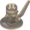
2" Seacock Body
-
1-1 4 in. IPS Intake Strainer Bronze Made in The USA
-
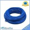
50ft 24AWG Cat6 550mhz UTP Ethernet Bare Copper Network Cable - Blue
-
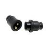
Molded Marine Connector 2 Conducter Seachoice 13801
-
America AT-140 Tuner
-
GPSMAP 76 - Marine, hiking GPS receiver - 2.9" monochrome - 240 x 180