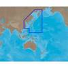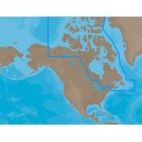
NA-M021 C-Card Format Canada North and East
Model: NA-M021 Brand: C-Map
NA-M021 => Canada North and East Coverage of the Arctic and Atlantic coasts of Canada including Hudson Bay, Newfoundland, the Gulf of St. Lawrence, Nova Scotia and the Bay of Fundy. Also includes coverage of the St. Lawrence River and eastern Lake Ontario, MacKenzie River, Great Bear Lake and all of Passamaquoddy Bay. « less
Product Specification
-
Universal Product Identifiers
Part Numbers: 30126, NA-M021, NA-M021C-CARDGTIN: 000000165836, 00686074002692
Related Products
-
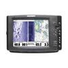
1100 Series 1197c SI Combo CHO - Marine Chartplotter - 10.4" color - 800 x 600
-
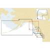
Electronic Chart - Cape CAUTION to Portland Canal, BC NA-C703
-
AN-M001 C-Card Format East China Sea & Kamchatka
-
20ft 24AWG Cat5e 350MHz UTP Bare Copper Ethernet Network Cable - White
-
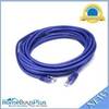
20ft 24AWG Cat5e 350MHz UTP Bare Copper Ethernet Network Cable - Purple
-
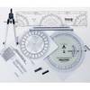
100 Marine Navigation Coast Guard Navigation Tool Kit
-
Navigation Light BAY15d Replacement Bulb 9353400
-
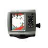
Fishfinder 400C - Fishfinder - included transducer - dual-beam
-
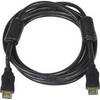
8ft 28AWG High Speed HDMI Cable w/Ferrite cores - Black
-
6ft 24AWG CL2 High Speed HDMI Cable w/ Net Jacket - White
-
Marine Products Plug Wire Set 9-28053
-
Lumishore THX36-G Thru-Hull Flush Fit Underwater Light - Green 36W