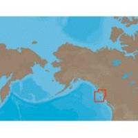
NA-C705 Furuno FP Format Banks Is BC Sumner Strait AK
Model: NA-C705 Brand: C-Map
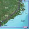
With are Electronic Sharts C-Maps we have: Olympia, Washington to Port Mcneill, British Columbia. Nannose to Victoria to Cape Scott Texada Island to Caamano Sound Cape Caution to Portland Canal Banks Island, British Columbia to Sumner Strait, Alaska Dixon Entrance to Icy Bay Gulf of Alaska Western Alaska NA-C705 Banks Island, BC To Sumner Strait, Alaska NT+ Cartography NT+ electronic charts feature much wider coverage areas at substantially lower prices. « less
Product Specification
-
Universal Product Identifiers
Part Numbers: 20183, NA-C705FURUNOFP
Related Products
-
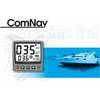
1500 Autopilot with Type 1 (60Ci/Min) with Rotary Feedback 10090009
-
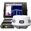
NSS12 Navigation Pack - NSS12, 3G Radar BSM-1
-
BlueChart g2 Vision - Norfolk-Charleston - Maps
-
Marine Naviled 360 All-Round Navigation Light
-
41320-1 S41 Port Navigation Light 24V, Black
-
3ft 24AWG CL2 High Speed HDMI Cable Male to Female Extension - Black
-
GC7266 Solid Cat6 RJ45 Plug (100-Pack)
-
PHF1 Female Phone Connector
-
Butt CONNECTOR, Single CRIMP, Nylon Insulated Red, 22-18, 100 Pack
-
18-8062 Fuel Line Connector 5/16"
-
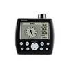
GPS 152H - Marine GPS receiver - 4" monochrome - 100 x 160
-
CrossoverGPS 2500T - Marine, hiking, automotive GPS receiver - 3.5" color