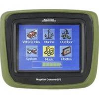
CrossoverGPS 2500T - Marine, hiking, automotive GPS receiver - 3.5" color
Model: 2500T Brand: Magellan
Navigate the streets, trails, lakes and oceans with this pocket-sized CrossoverGPS. With all the standard features of the advanced Magellan auto navigation GPS products, plus the ability to go from the open road to the great outdoors. Enjoy driving, hiking, boating, fishing and more, all with one GPS! Simple touch-screen menus, turn-by-turn voice guidance and upgradeable to receive Real-time traffic alerts. « less
Product Specification
-
General
Product Type: GPS receiverRecommended Use: Marine, hiking, automotivePreloaded Maps: 48 United StatesReceiver: 20 channelIntegrated Components: Digital playerCard Reader: SD Memory CardInterface: USBVoice: Navigation instructionsSBAS: WAAS, EGNOSAntenna: Built-inAccuracy: Position - 10 ft - 16 ft ( with WAAS ) Position - 23 ftInternal Memory: 4 GB HDDFeatures: Built-in HDD, built-in speaker, 2D / 3D map perspective, preinstalled POIsFirst Seen On Google Shopping: November 2006 -
Display
Type: TFT - color - touch screenDiagonal Size: 3.5"Display Illumination: Yes -
Acquisition Times
Hot: 1 secCold: 40 sec -
Navigation
Trip Computer: Avoid toll roads, avoid freeways, fast/short route, Back-On-Track -
Media Player
Supported Audio Formats: MP3, WMASupported Image Formats: JPG -
Connections
Interfaces: Serial - USB Headphones -
Battery
Type: Lithium ionRun Time (Up To): 8 hours -
Miscellaneous
Protection: WaterproofWaterproof Standard: IPX4 -
Dimensions & Weight
Width: 4.3 inDepth: 1.1 inHeight: 3.4 inWeight: 8.5 oz -
Environmental Parameters
Min Operating Temperature: 14 °FMax Operating Temperature: 140 °F -
Universal Product Identifiers
Part Numbers: 2500T, 980890-01GTIN: 00076335710570, 00763357115703
Related Products
-
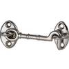
4in Plain Bronze Door Hook
-
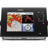
000-10196-001 - NSS8 US 8 Touchscreen MFD/Sounder
-
Cat6a Ethernet Cable | 7ft | Black | Network | 10 Gigabit
-
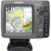
700 Series 788ci Combo CHO - Marine Chartplotter - 5" color - 640 x 640
-
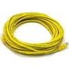
25ft 24AWG Cat5e 350MHz UTP Bare Copper Ethernet Network Cable - Yellow
-
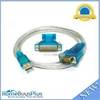
USB to RS232 DB9 male(Serial) / DB25 Male Converter Cable
-
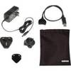
Travel Kit USB cable with AC adapter - 4 pin USB Type A - M - PC
-
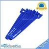
Hook & Loop Fastening Cable Ties 6inch, 50pcs/Pack - Blue
-
10gb Fiber Optic Cable, LC/SC, Multi Mode, Duplex - 10 Meter
-
/ Quicksilver 881175A 1 Connector Cap asy
-
CONNECTOR, Female Tab 22-18 x .187 25 Per Package
-
E55058 Seatalk HS Network Switch