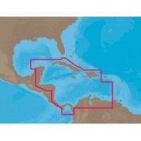
NA-C502 Furuno FP Format Western Caribbean S
Model: NA-C502 Brand: C-Map
NA-M320 => Passamaquoddy Bay to Cape LookoutCoverage includes offshore bathymetric details from Passamaquoddy Bay, ME to Cape Lookout, NC. Coverage extends from the coastline out to the Atlantic Canyons - Hudson, Baltimore, Oceanographer and others. Fishing Contour Charts do not include coastal navigational features and are recommended for offshore fishing only. « less
Product Specification
-
Universal Product Identifiers
Part Numbers: 20172, 31356, CMANAC502FP, NA-C502, NA-C502FURUNOFP, NA-M320-SD, NA-M320SDCARDGTIN: 00686074003835
Related Products
-
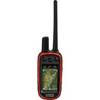
010-01041-20 Alphae 100 GPS Track & Train Handheld
-
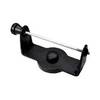
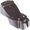
GPS receiver marine swivel mounting bracket
-
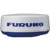
17144 4Kw Radome 36NM Range for 1832 33 34
-
Marinenav Explorer Marine Navigation PC Computer EXP-013-intel
-
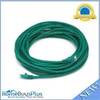
30ft 24AWG Cat5e 350MHz UTP Bare Copper Ethernet Network Cable - Green
-
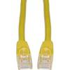
Cat6a Ethernet Cable | 2ft | Yellow | Network | 10 Gigabit
-
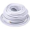
100ft RG6 (18AWG) 75OHM, Quad Shield, CL2 Coaxial Cable with F Type Connector - White
-
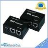
4064 DVI Extender Using Cat5e Cable Extending Upto 50 Meter, Supporting DDC & HDCP
-
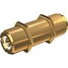
PL-258-L-G Bulkhead Barrell Connector for PL-259
-
P66-BL with Lowrance Blue Connector 50/200 D/S/T
-
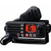
Eclipse DSC+ Fixed Mount VHF, Eclipse DSC 25W VHF Fixed Black
-
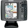
700 Series 757c Combo CHO - Marine Chartplotter - 5" color - 240 x 320